
In my previous post, I told of my excitement (odd, some might say) at taking a day trip to the English border town of Berwick-upon-Tweed during a recent visit to friends in Edinburgh.
I recounted how we walked the majority of the town’s Elizabethan defensive walls, visited the lighthouse at the mouth of the River Tweed and then set off north to hike the first few miles of the Berwickshire Coastal Path. The post ended as we were approaching the Scottish border, something which inspired great elation on my part (despite the fact that we’d come to Berwick from Scotland, a few hours earlier, by train).
Below are some photos and thoughts from the remainder of the walk plus some taken back in the town afterwards.
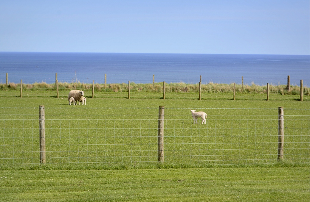
Spring lambs at Marshall Meadows, just south of the border
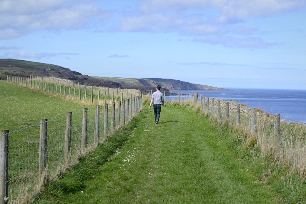
James enjoying the final, pleasant stretch of the path before the border
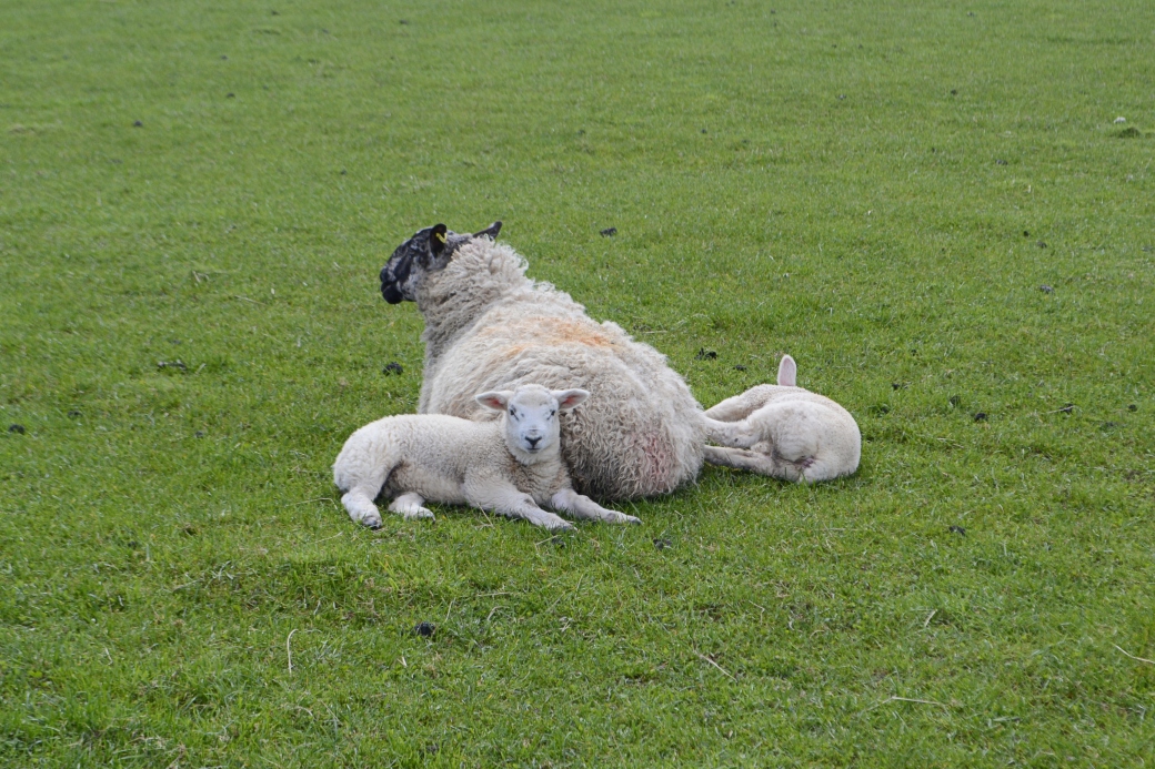
A closer view of some of England’s most northerly lambs, just off the path here
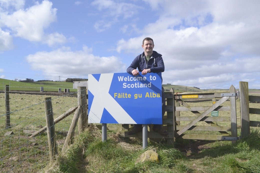
Finally at the border, the scene of much jubilation and photo taking. Assuming the fence and gate mark the actual border, then this sign is actually just inside England… which bothered me slightly.
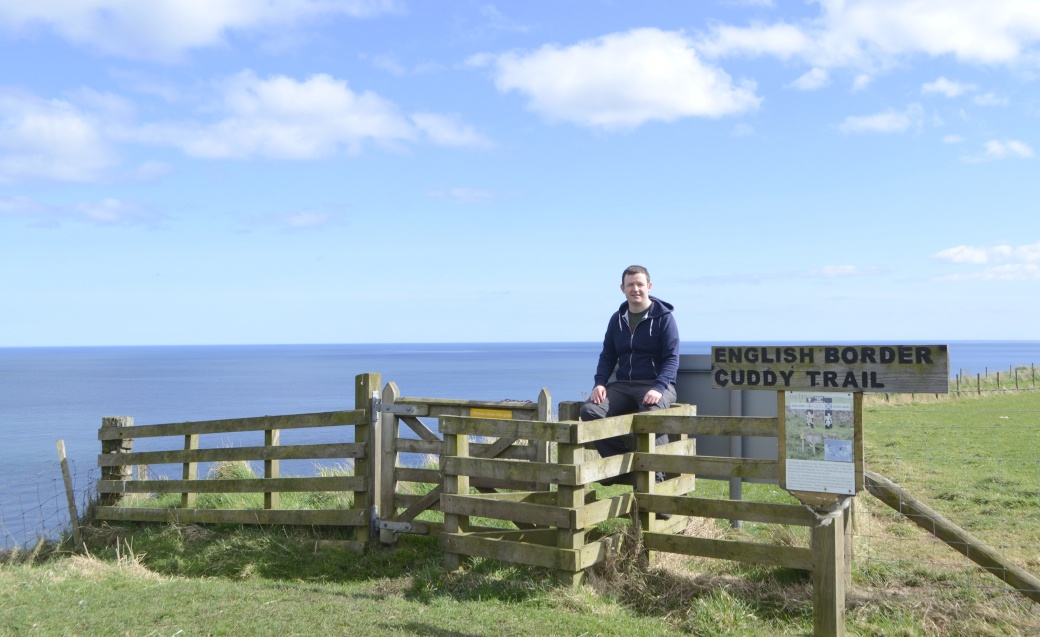
From the other side
The sign tells how the boundary dates back to 1237 at this unassuming point when it was established under the Treaty of York, signed by Henry III of England and Alexander II of Scotland. There were many later disputes but in 1482 Berwick was finally taken by the English and the border fixed here.
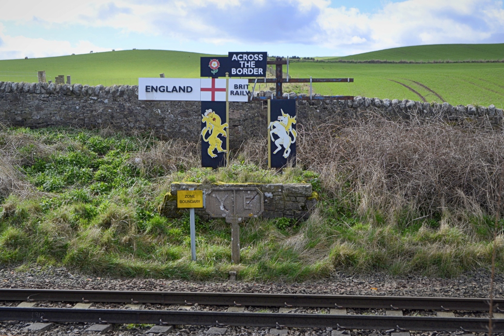
The boundary is also marked on the railway line, just a short distance inland from the path. The fact that the Scotland sign has disappeared might be seen as prophetic.
Our border fix sated, we set off back towards Berwick. Rather than retrace our steps along the winding and undulating coastal path, we chose the more direct but less scenic option of walking alongside the busy A1 Edinburgh to Newcastle dual carriageway, which fortunately has an adjoining footpath.
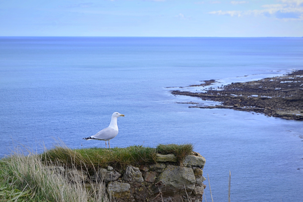
Loved this content-looking chap I spotted just after we turned back
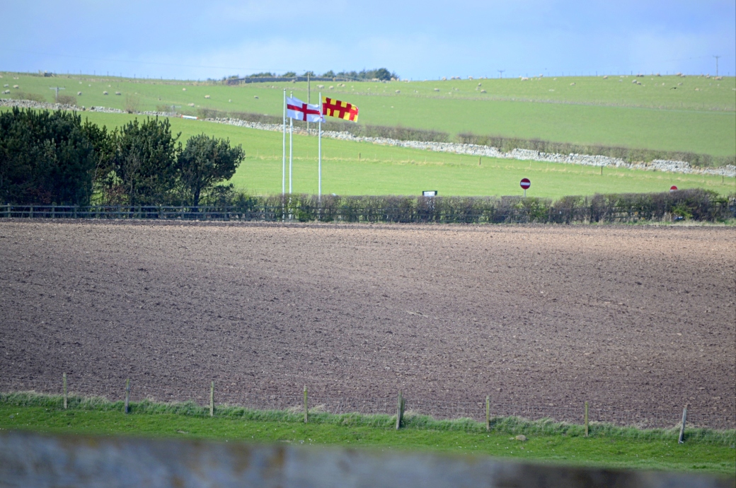
Zoomed in view of England and Northumberland flags marking the border along the A1
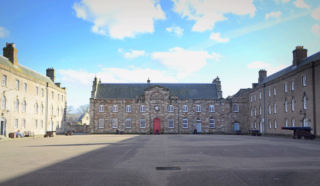
Back in Berwick and after getting fed, we visited the town’s Barracks, dating to the early 18th century and one of the first to be purpose-built in Britain. The site is run by English Heritage and houses three museums.
The main exhibition explores the professional and personal lives of British infantrymen over the centuries. The displays are a bit dated and text-heavy (I was pretty tired by this stage, which didn’t help) but are still worth a look, even if it wasn’t an area I had much personal interest in. A highlight for me was trying a sample of Mead for the first time in the gift shop (I tried some more later on as James bought a bottle of it).
After leaving the Barracks, we rejoined the town walls and completed most of the circuit from earlier.
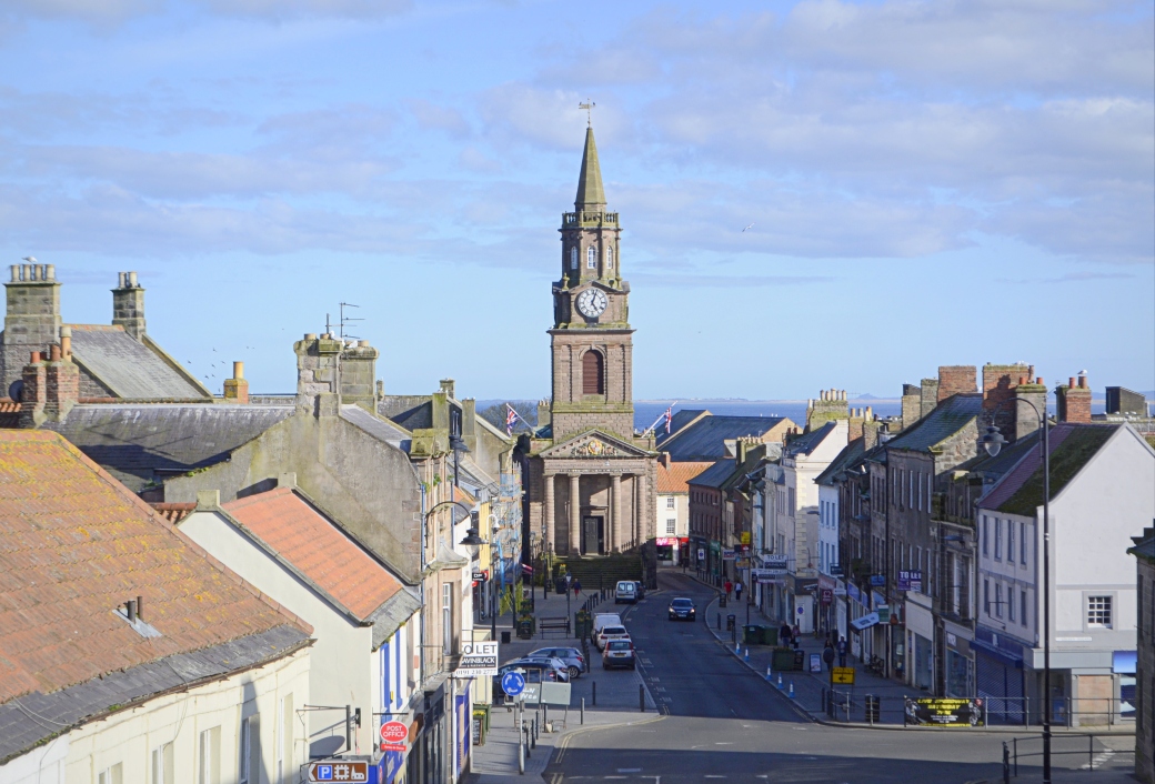
A much photographed view down Berwick’s main street towards the Town Hall, from Scots Gate on the walls. Half of the street lies outside the walls, behind me.
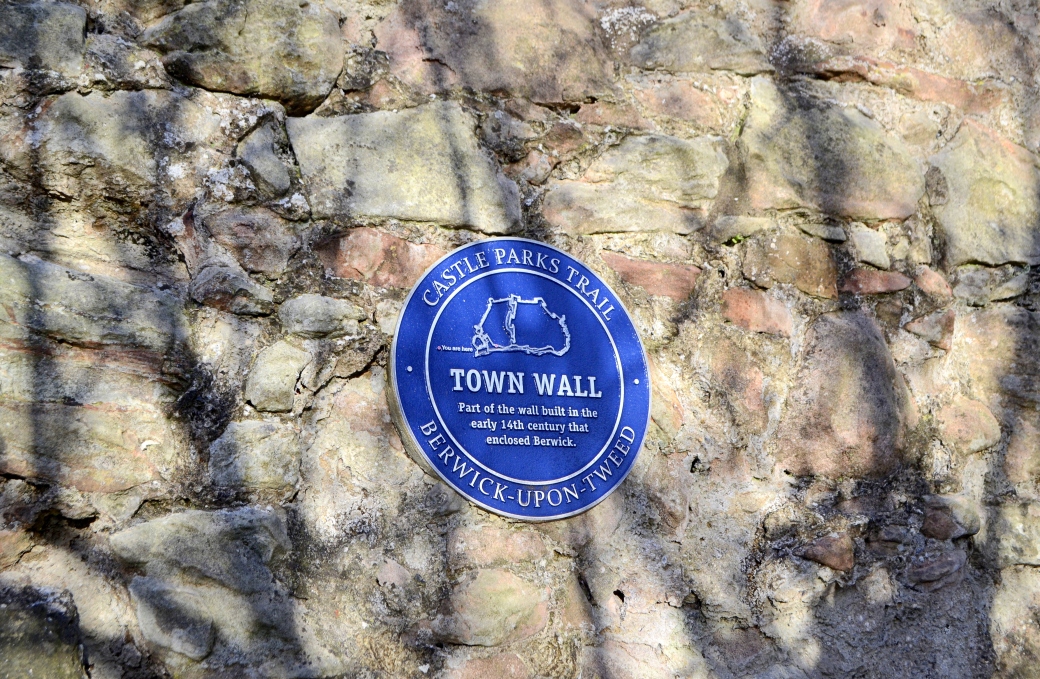
A surviving section of Berwick’s original defensive walls, built in the early 14th century under England’s Edward I. These walls were longer than the Elizabethan ones which replaced them. Berwick Castle, of which little remains, stood outside these earlier walls.
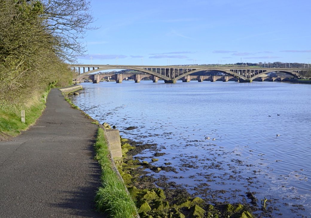
The riverside path along the Tweed, with a view of the town’s two road bridges
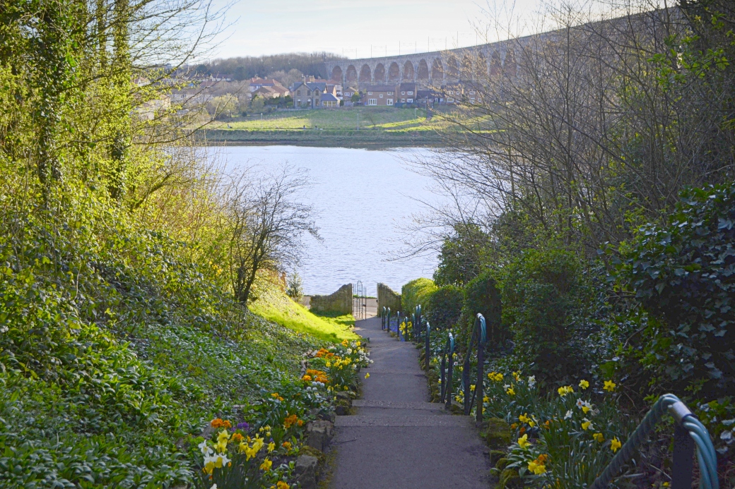
The river and railway viaduct from the beautiful Castle Vale Park
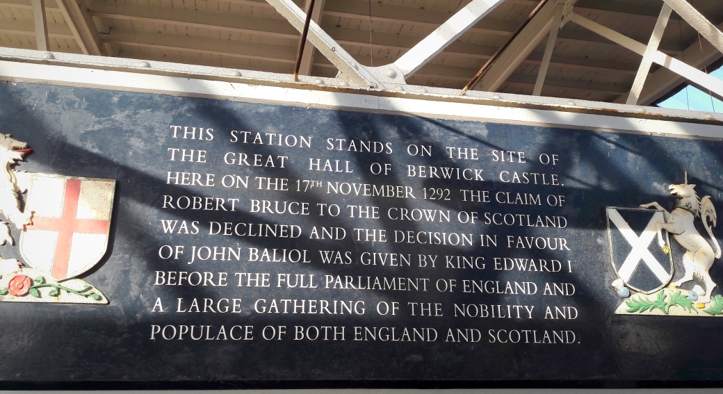
Berwick, where even the train station is a historic site
In all, a really enjoyable day in Berwick (or South Berwick as I’ve taken to calling it, the name the Scots used to distinguish it from the coastal town of North Berwick near Edinburgh). Even besides the border interest which first drew me to it, it’s a gorgeous town. I’d love to revisit it one day and walk some more of the Berwickshire Coastal Path, and also the Northumberland Coast Path which also begins/ends here. It’s a corner of Britain that’s really captivated me.
Total distance (Pier Road to the border via coast and back to town centre via A1): 12.4km / 7.7 miles
Also from this trip:
Bastions and Border-Hopping in Berwick: Part 1
Hills of Edinburgh: Calton Hill and Blackford Hill
Some useful links:
www.visitberwick.com
https://rucksackrose.com/long-distance-trails/berwickshire-coastal-path (blog post on full route, with video)
www.walkhighlands.co.uk/borders/berwickshire-coastal-path.shtml
www.scotborders.gov.uk/directory_record/7469/berwickshire_coastal_path (has link to nice pdf brochure)

Glad to see the second part of our trip up! It was a great walk. Overall we did walk a lot longer! With the ramparts and wandering around the town too. Tired feet that night. Also must order that mead if I can…
LikeLike
Yes there was a lot of walking done that day. I was always on the lookout for a bench. Order me a bottle while you’re at it…
LikeLike
Brilliant article Martin – really get the experience across, and great photos to complement it. Looks like you had the area well explored.
LikeLiked by 1 person
Cheers Aidy, really liked that area. Got me wanting to do more of the long distance routes over there, so many to choose from, they do seem to have better countryside access than us.
LikeLike
Seems that way Martin. I’ve found myself on short stretches of the Ulster Way a few times though, and considered what it would be like to walk the whole thing. There’s even an official extension of the Appalachian Trail now, over mountains here that were once part of the same range! I’ve noticed more trails south of the border too, so maybe things are improving.
LikeLike
It is getting better and it’s always great to hear about new trails. I want to get down to Waterford to cycle their new greenway. There are some very good sections of the Ulster Way, I did the full Moyle Way a few years ago over 2 days and it was a great experience. Nice to see the Appalachian Trail signs here now too. They do seem to have more long, off-road routes across the water though, would like to see more of that here. By the way, I signed up for the Sligo Camino in July, it’s 34km which should be interesting!
LikeLiked by 2 people
Haven’t heard of that one Martin – look forward to a post on it hopefully 🙂
LikeLike
Not sure I’ll get a chance to take many photos on that one, Aidy! It’s a challenge walk following part of the Sligo Way route.
LikeLike
I could see there could be enough on your plate that day alright 🙂
LikeLiked by 1 person
Nicely done again Marty. Those pictures look postcard perfect. Obviously a picturesque area.
LikeLiked by 1 person
Thanks Canice, yes I really liked it. Want to get back and see more of the coast and hills.
LikeLike