I thought I’d pull myself away from the hilarious online commentary on the UK General Election and add a post on one of my favourite local places to visit.
Tullyhogue Fort is one of the most important sites in medieval Irish history. It’s also a beautiful and tranquil viewpoint that’s been made a lot more accessible recently.
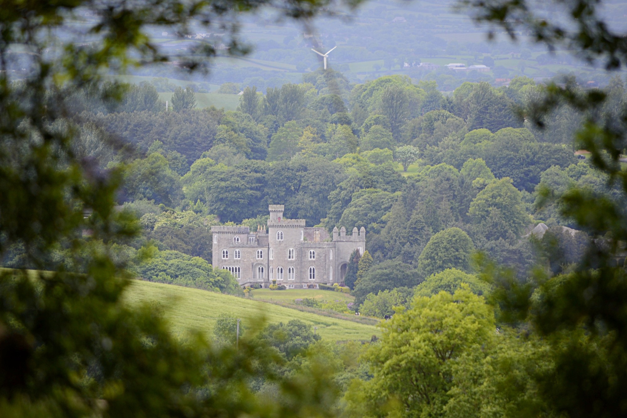
Top image: a framed view of Killymoon Castle just outside Cookstown, taken from the earthwork
The circular earthwork enclosure of Tullyhogue (which has multiple spellings including Tullaghoge) is thought have been an early ritual site. It gained prominence in the 11th century as the dynastic centre and inauguration place for the Gaelic chieftains who would become known as the Northern O’Neills.
The last chief to be crowned here was the famous Hugh O’Neill, Earl of Tyrone, in 1595. He would ultimately leave Ireland for Rome as part of the Flight of the Earls in 1607, following military defeat and a loss of land and prestige at the hands of the English.
I’ve visited the site several times over the years. Despite its peaceful atmosphere and historical significance, it always felt a little neglected and forgotten. Accessibility was a big factor: the small, dark and slightly creepy parking area was located just off a treacherous bend on a busy road, with a steep concrete track leading up to the enclosure. I’d cycled this track a couple of times and it was a real leg buster (never mind having to lift my bike over the high gate).
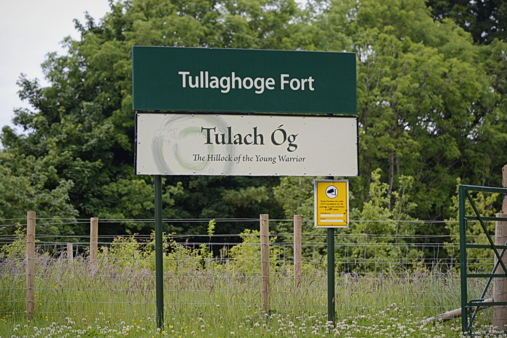
Sign at the new entrance to the site
The local Mid Ulster Council have done a fantastic job opening up the site in the past couple of years. There’s now a much bigger and more conveniently located car park, picnic tables, benches, sculptures and a new, gently winding path leading up to the enclosure. This is dotted with a number of interpretation panels exploring the history of Tullyhogue (which I’ve yet to read in full). It’s been completely transformed and is now much more popular with locals and visitors, resembling a public park.
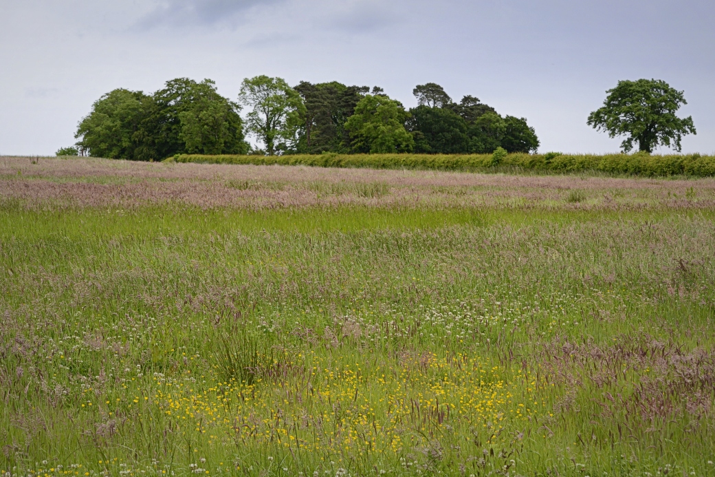
I love the views from the hilltop, which are some of the best in the area. These include the town of Cookstown to the north, with the Sperrin Mountains and most prominently, Slieve Gallion beyond. The Antrim Hills, including the rounded bulk of Slemish, are visible to the northeast, with a slither of Lough Neagh to the east. Walking around the tree-shaded earthwork is a lovely experience, though I didn’t take any close-up photos on my most recent visit as I only had my long lens.
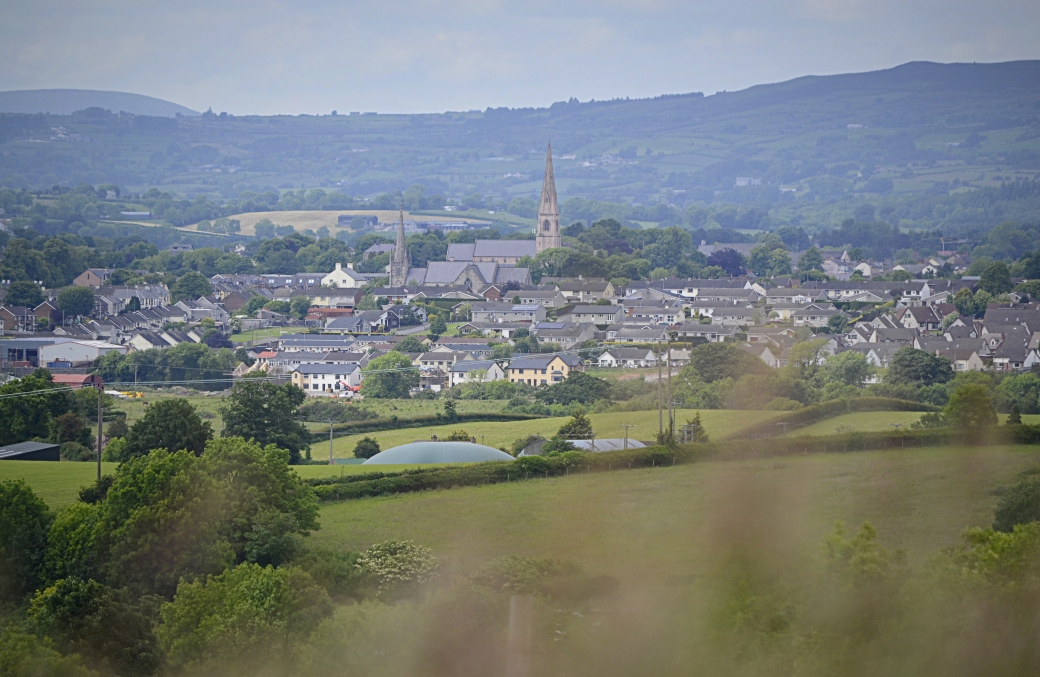
The scenically located town of Cookstown; the Catholic Holy Trinity Church dominates the long main street, with the smaller St. Luran’s Church of Ireland to the left
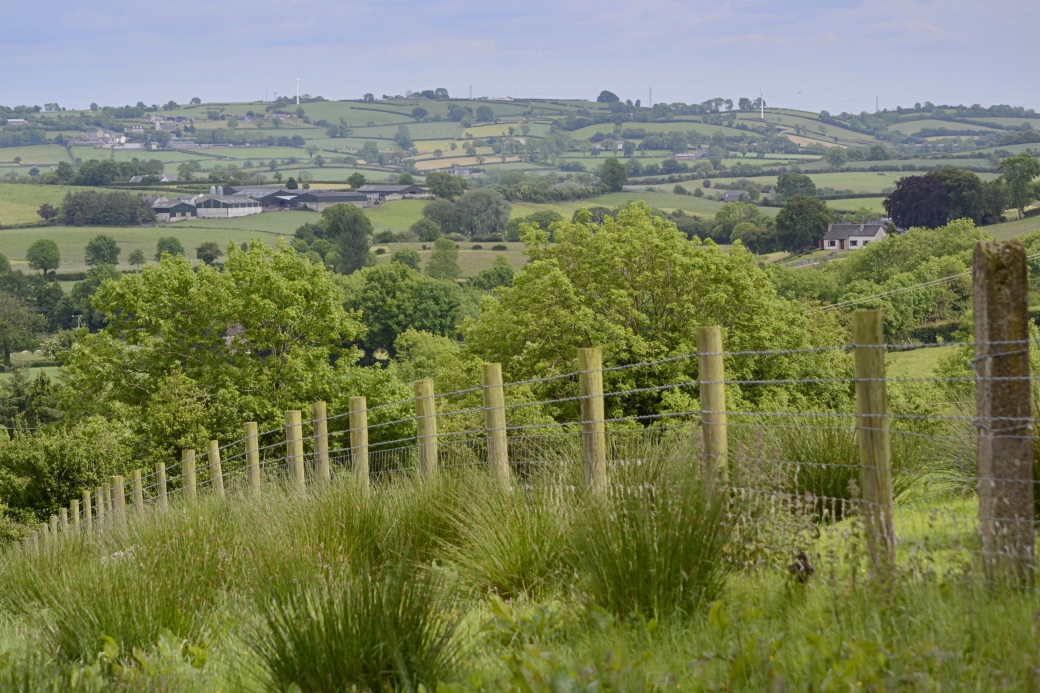
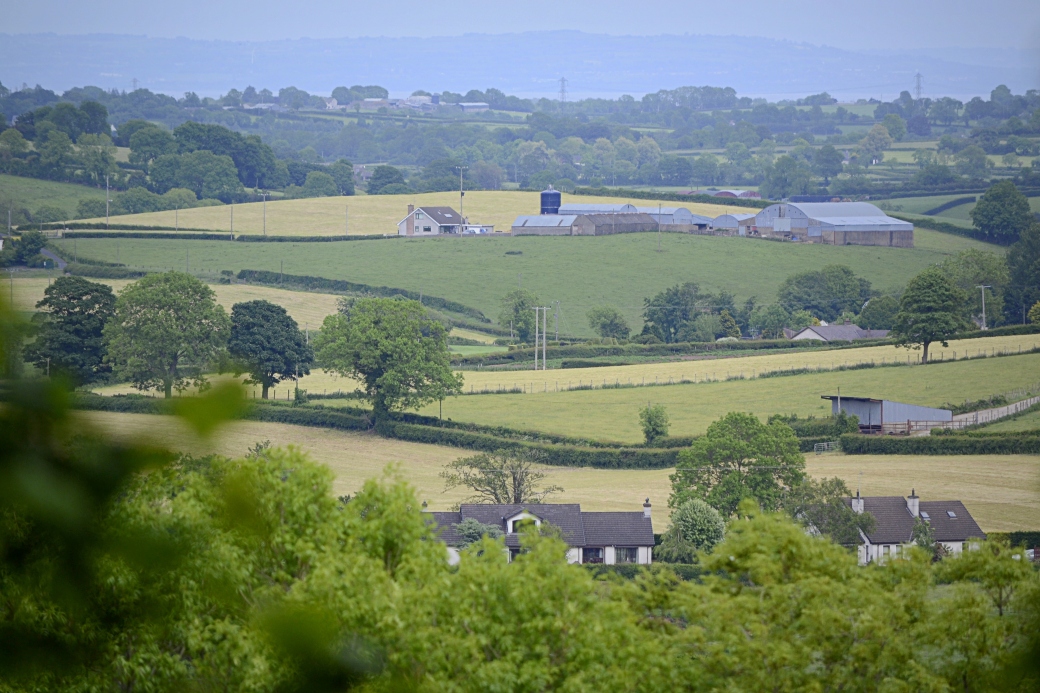
A couple of views of the lowly undulating east Tyrone countryside nearby; you can see part of Lough Neagh in the bottom shot, with County Antrim beyond
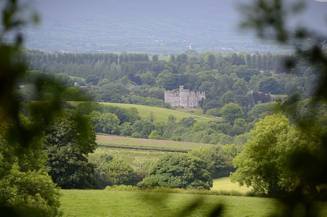
A less zoomed view of Killymoon Castle, with the slopes of Slieve Gallion beyond
It was built in the early 1800s to replace an older Plantation castle destroyed by fire, to a design by famous London architect John Nash. The building is currently a private residence but now houses a public tearoom which I’ve yet to visit. Its parkland is home to Cookstown Golf Club.
Looking back on the enclosure on my way down
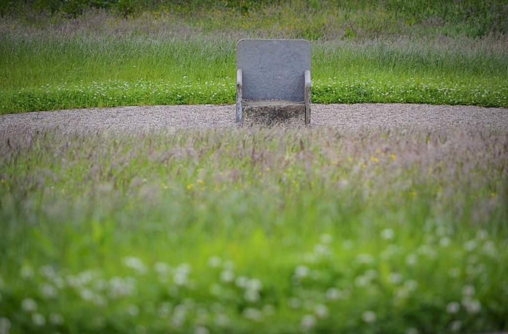
A newly built replica of the Leac na Rí (Stone of the Kings) at the bottom of the hill
The original coronation chair of the O’Neills was destroyed by the English army, led by Lord Mountjoy, during the Nine Years’ War in 1602. A contemporary map attributed to English cartographer Richard Bartlett (see Page 4 of this study of the site) shows the chair located down the hill from the enclosure. Parts of the chair are thought to have been located in a nearby field, and a local legend also holds that a fragment was incorporated into the porch of a nearby Protestant church, Desertcreat Parish Church.
As I headed back to my car, I stopped to take a look at a couple of the interpretation panels. These told how, during excavation for the new car park, archaeologists discovered a previously unknown settlement. Findings included the footprints of two houses, probably belonging to farmers, dating to 1170 – 1200 and a large, thatched timber hall dating to around 1500. The latter is thought to have been used for entertaining the social elite on special occasions.
Location: on the B520 Stewartstown to Cookstown road, just north of Tullyhogue village
More information:
www.qub.ac.uk/schools/CentreforArchaeologicalFieldworkCAF/PDFFileStore/Filetoupload,181156,en.pdf |
www.discovernorthernireland.com/Tullaghoge-Fort-Tullyhogue-Cookstown-P2950 |
www.bbc.co.uk/news/uk-northern-ireland-29068832

Oh I’m intrigued now. I visited the site a few years ago and also thought it very neglected. Must make a point of visiting the next time I’m passing through. It reminds me a lot of Doon Rock in Donegal, inauguration site of the O’Donnell chiefs. Nice pics of the undulating countryside.
LikeLiked by 1 person
You’d hardly recognise it now. The old entrance is completely gone, planted over, and the new path crosses the old track at a right angle. Definitely visit again if you are nearby.
LikeLike
Fascinating Martin – I wasn’t aware of this location, and it will definitely spur me to visit, which is just want you want from a blog 🙂 Reminded me too about Killymoon Castle which I’ve wanted to go and see for a while – do you know if it is accessible?
LikeLiked by 1 person
I suppose if its got a tea room it must be accessible to some extent – would love a good wander round the grounds and exterior though!
LikeLiked by 1 person
Thanks Aidy, I do try to sell these places! 🙂 I only found out about the tearoom the other day, think it’s new enough. It’s a good opportunity to get a nosy so I might check it out. Think you could always drive up and have a look though, and they have tours during the European Heritage Open Days weekend in September, maybe one or two other dates in the year. Definitely visit Tullyhogue Fort if you can, it’s a special place.
LikeLike
Both on my list now then Martin. You’ve sold them to me 🙂
LikeLiked by 1 person
I think visits are available at certain times, certain days. I’m not sure if there’s a website but “Tommy’s Kitchen” is 028 8676 4173.
LikeLiked by 1 person
Thanks Ashley, they have a Facebook page too https://www.facebook.com/tommyskitchenatkillymooncastle/. Looks like it’s open Thurs – Sat. Definitely want to try it out.
LikeLiked by 2 people
I had a lovely lunch there a couple of months ago after a visit to Cabin Wood, which is on the other side of the Ballinderry River when I was taking part in some tree ID training.
LikeLiked by 1 person
That’s a nice walk too, must do it again. Don’t think it’s that well known.
LikeLiked by 1 person
This looks great!
LikeLiked by 1 person
It is, I enjoy it every time I visit. Lovely atmosphere.
LikeLiked by 1 person