This charity hike with the Holey Soles Hill Walking Club visited a quiet corner of an Irish county I’ve long had a soft spot for, Leitrim.
Sometimes known as Boleybrack Mountain, this area of upland heath and bog lies to the southeast of Manorhamilton and southwest of Glenfarne. It is the site of a successful conservation project for Irish Red Grouse.
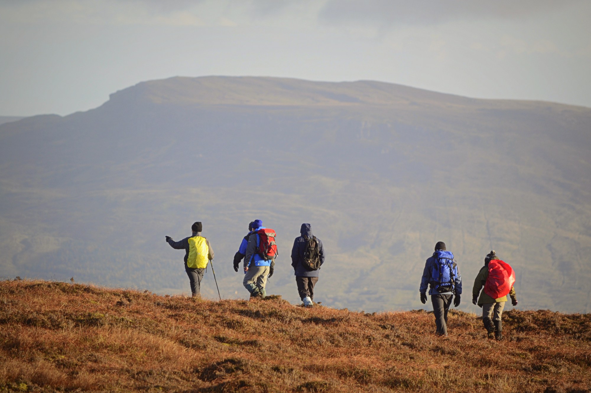
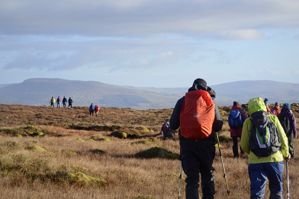
Top image: Some of the group with The Playbank mountain beyond
Our walk started high up on the hillside at a parking area for the Leitrim Way walking route, at G953359. We followed the waymarked track to Doo Lough then cut off over open mountain to visit several other loughs before ascending to the high point at Lackagh Mountain (449m). From here we headed northeast back towards Doo Lough, keeping the large forest to our right. Our lunch spot was at Lough Kip, the largest lake we visited.
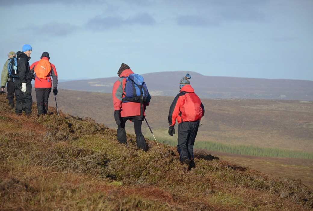
Below are some of the views during the course of the walk. These were extensive (if hazy at times), taking in the surrounding hills, mountains and lakes, and stretching from the coast at Sligo Bay deep inland.
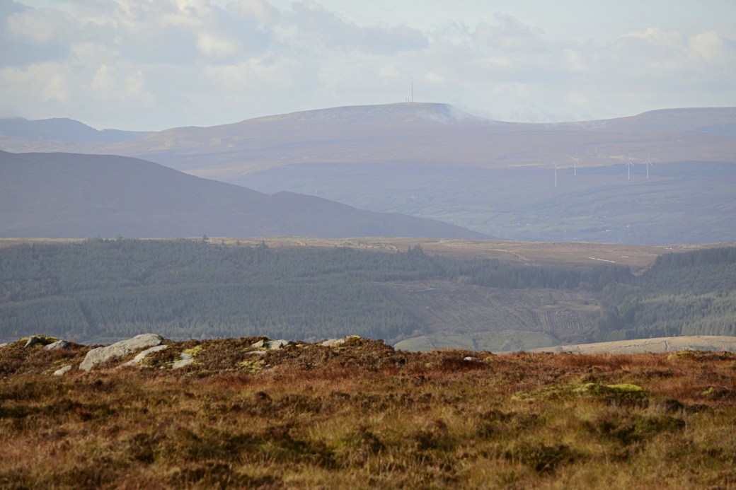
View northwest towards Truskmore (with the TV transmitter), the highest of the Dartry Mountains and County High Point of both Sligo and Leitrim.
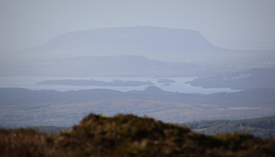
West across Lough Gill to Knocknarea with its huge summit cairn known as Queen Maeve’s Grave
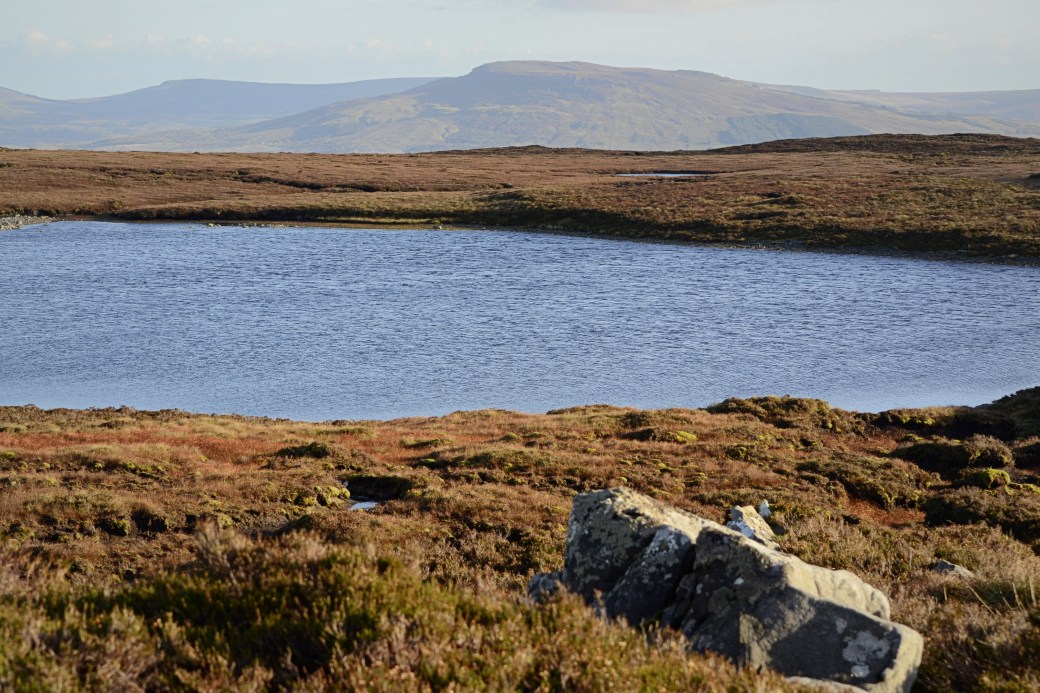
Lough Strand, one of the numerous lakes dotted around Boleybrack, with Cuilcagh and The Playbank mountains beyond
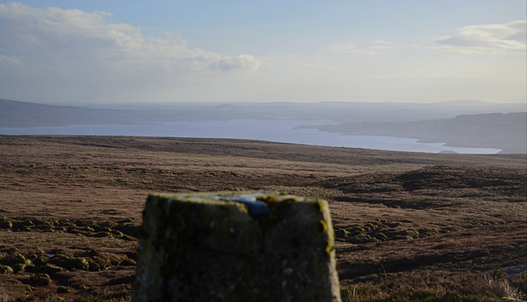
The summit trig pilliar on Lackagh Mountain with Lough Allen beyond
Setting off from the summit with views of the mountains on the far shore of Lough Allen
On the way back to our start point, with Thur Mountain in the distance to the north
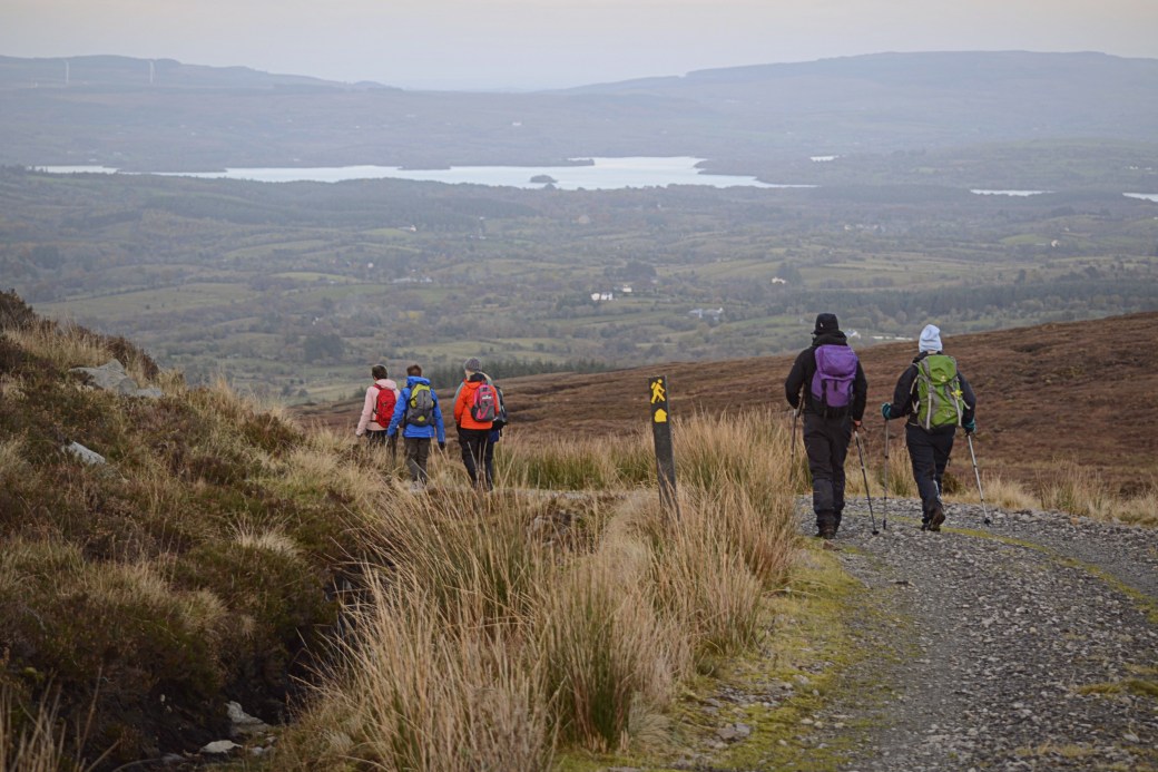
Almost back at our start point, with a great view over Lough Macnean Upper; it straddles Leitrim, Fermanagh and Cavan
Total distance: 14.2km / 8.8 miles
Map: OSI or OSNI 26

Looked like a nice walk, and the weather seemed to play ball. Some nice extensive views.
LikeLiked by 1 person
yet again another great blog. You took some lovely photos.
LikeLiked by 1 person
Thanks Polly, the views were fantastic. I definitely want to walk more in those hills.
LikeLiked by 1 person
Reading this blog has put a notion in my head that I should walk this land! Your photos are wonderful and have me wanting to get out there.
LikeLiked by 1 person
Hi Ashley, thanks for the nice comments. Definitely some great places to walk around Ireland, I’ve been hiking for years now and there are always new places to explore. Where are you based?
LikeLiked by 1 person
Hi Martin. I live near Armagh, where I was born within earshot of the old cathedral bells. After 60+ years they still resonate!!! However, I’m not as fit as I used to be but still I hanker after the hills. Next week I will spend a day in the Silent Valley in the Mourne Mountains but I won’t be walking……I hope to be planting trees! Where are you based?
LikeLiked by 1 person
Ahh sorry, thought maybe you were across the water, not 20 mins from me!! I live near Coalisland and the lough shore. Armagh’s a lovely city. I’ve only ever seen the Silent Valley from above but keep meaning to visit, the views and parkland look beautiful and more trees sounds like a good idea!
LikeLike
Great stuff Martin – that’s a new area for me even though I’ve walked some of the areas you can see in your photos. Inspiring me to follow your tracks up Lackagh
LikeLiked by 1 person
Cheers Aidy, I hadn’t walked too much in those parts myself. It’s a plateau with not much climbing once you’re up there, there’s another Mountainviews summit we passed close to but didn’t go to the top of, Ballaghnabehy. Definitely an interesting area that I’ll return to.
LikeLike
wonderful photos from this trip, was it a fairly easy hike?
LikeLiked by 1 person
Thanks Vanessa, yes it was fairly easy because we started off pretty high up so there wasn’t a huge amount of climbing. It was mostly over open mountain rather than tracks though so the terrain was tiring at times.
LikeLiked by 1 person