I’ve got out of the habit of blogging for a while (the bad weather and lack of outings may have played a part; temporarily adopting two guinea pigs may have been another factor) so I thought I’d check in.
I still have to add a Part 2 to the ‘Places I’d Love to Revisit’ but in the meantime here are some photos from my hikes between January and March 2018.
First off, I recently joined Instagram so here’s a plug for my account, if you want to connect over there.
Cavan Burren and into Fermanagh
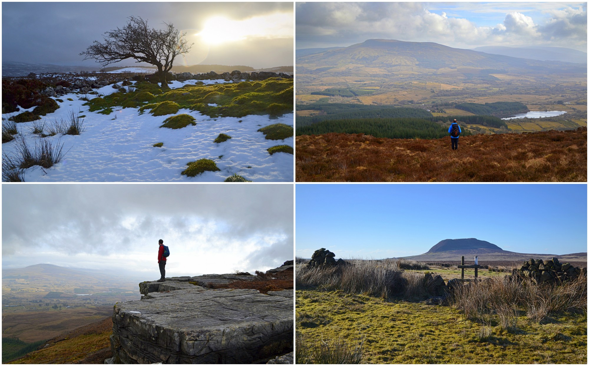
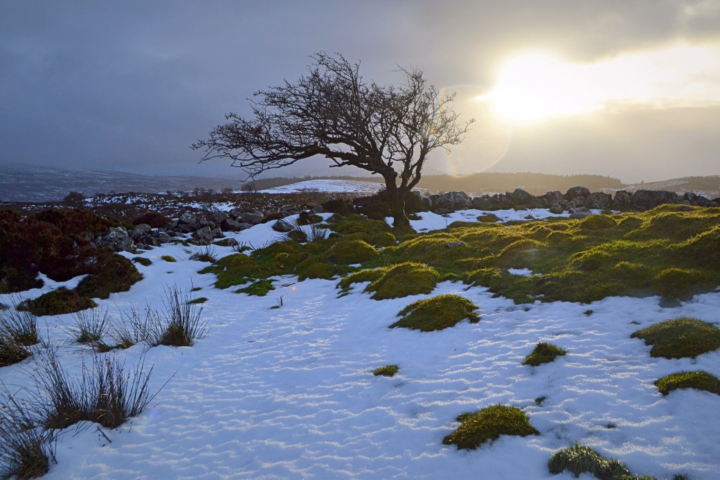
Back on a wet and wintry Sunday in January, I did a 13km hike up to and around Cavan Burren Park, crossing into the Marlbank area of adjoining County Fermanagh.
The Burren sits on a limestone plateau and the surrounding area is both geologically and archaeologically significant, with lots of prehistoric tombs and other structures dotted around. The Burren has been made accessible in recent years with new trails and interpretation. I enjoyed the sections of boardwalk, which were under construction during my last visit back in 2013.
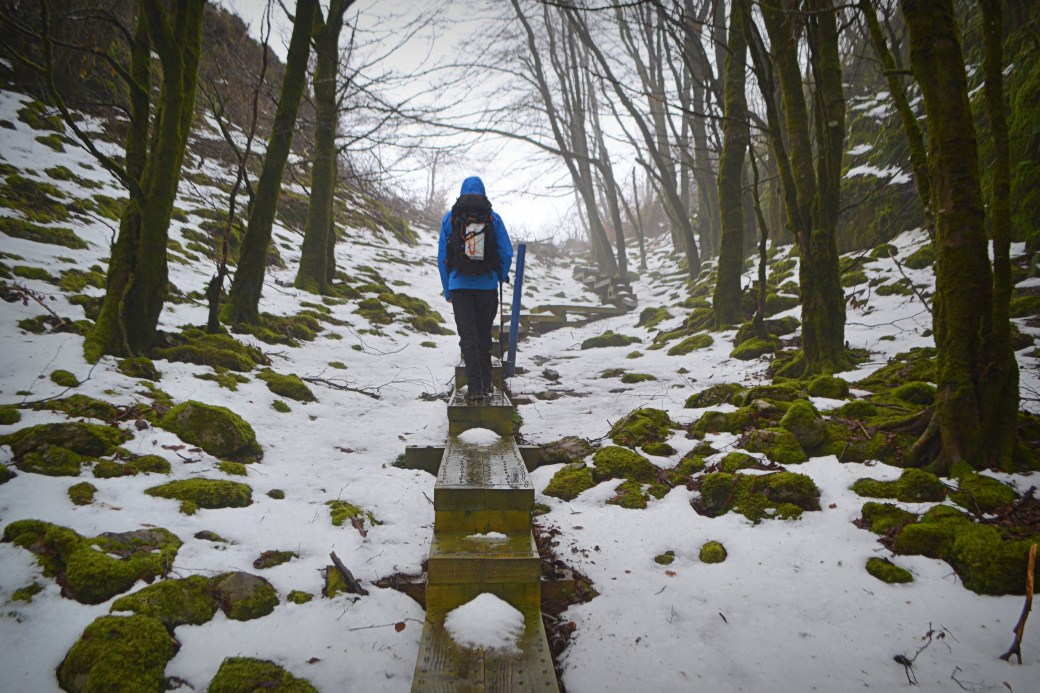
A lovely section of boardwalk leading up to the megalithic structure known as the Giant’s Grave
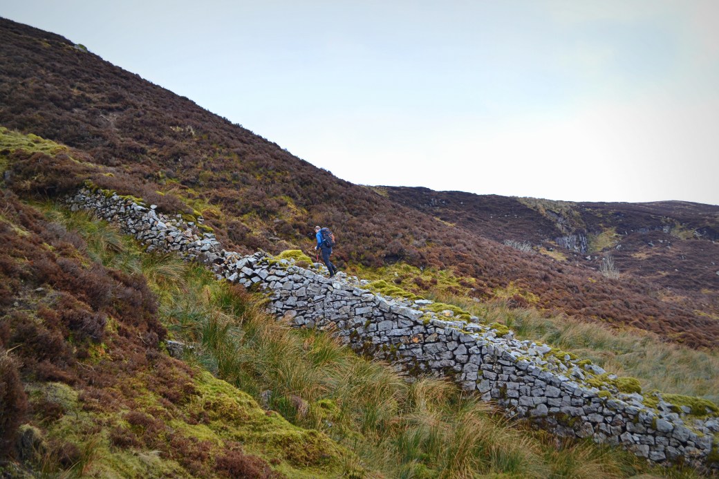
We left the Burren to aim for a feature I’d long noticed on the Ordnance Survey map, a cashel (stone ringfort) located a short distance away on the Fermanagh side, but across difficult terrain. The weather took a turn for the better just as we got there, and the hilltop location offered a fantastic viewpoint over the twin lakes of Macnean Upper and Lower and the surrounding hills.
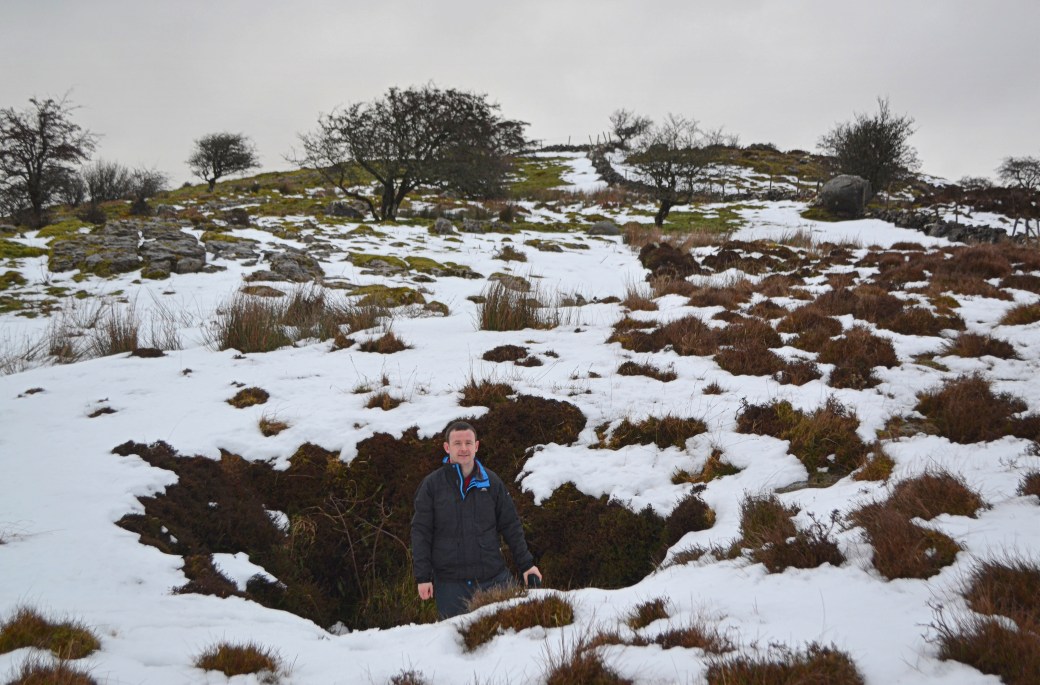
Me standing inside a sinkhole en route to the cashel; the low stone wall and fence on the top right mark the border between Cavan and Fermanagh (and the ‘Irish Border’, much talked about these days)
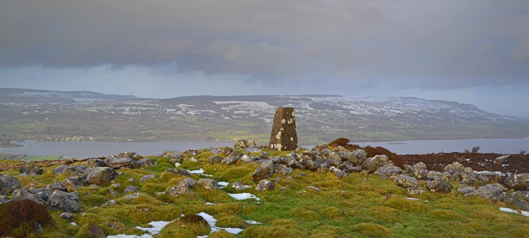
The hilltop cashel just inside Fermanagh, with Lough Macnean Lower and Belmore Mountain beyond to the north
An unexpected evening sunburst taken inside the cashel
Naweeloge Top and an old tramway
I returned to the same general area earlier this month, to tackle a little known hill known (on MountainViews.ie, anyway) as Naweeloge Top.
Our start point and most of our looped route was in Cavan but the summit lay across the invisible provincial boundary in County Leitrim. I’d walked in this corner of Leitrim before and it’s quite an interesting area (well, to people like me), consisting of a large boggy plateau dotted with numerous loughs and the occasional stone cairn.
A particularly unusual feature on our ascent was the remains of a steep tramway once used to transport coal down from the hill.
Canice walking up the tramway, which could pass for a minor wall in the Mournes
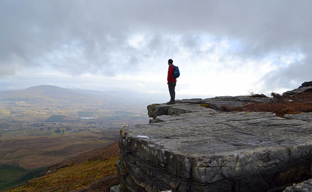
Can’t beat a rocky outcrop with a view; this one is looking back over northwest Cavan
This one required a bit of a detour but gave an excellent view across Lough Macnean Upper to the northeast, which straddles Cavan, Leitrim and Fermanagh
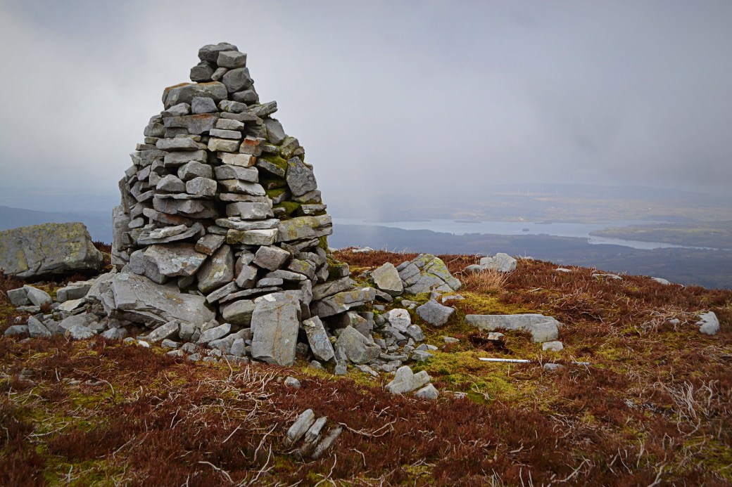
The most impressive (especially from a distance) of the cairns we visited, located beyond the summit
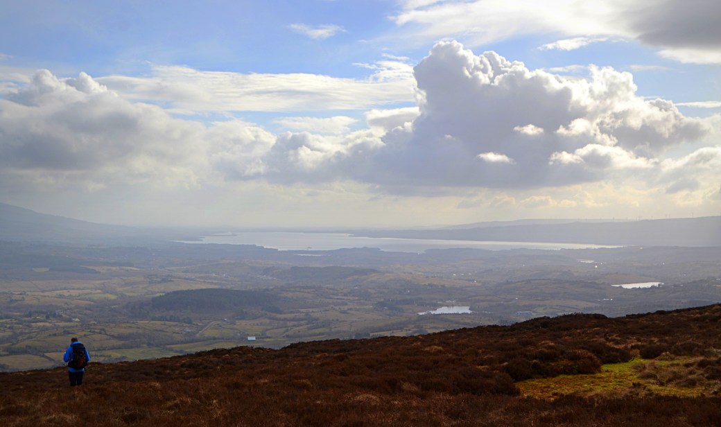
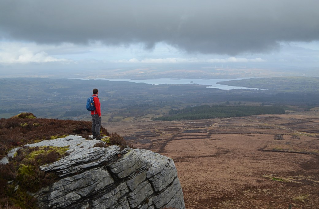
The southern part of the plateau gave an excellent view over Lough Allen, the first big lake of the Shannon system, which straddles Leitrim and Roscommon
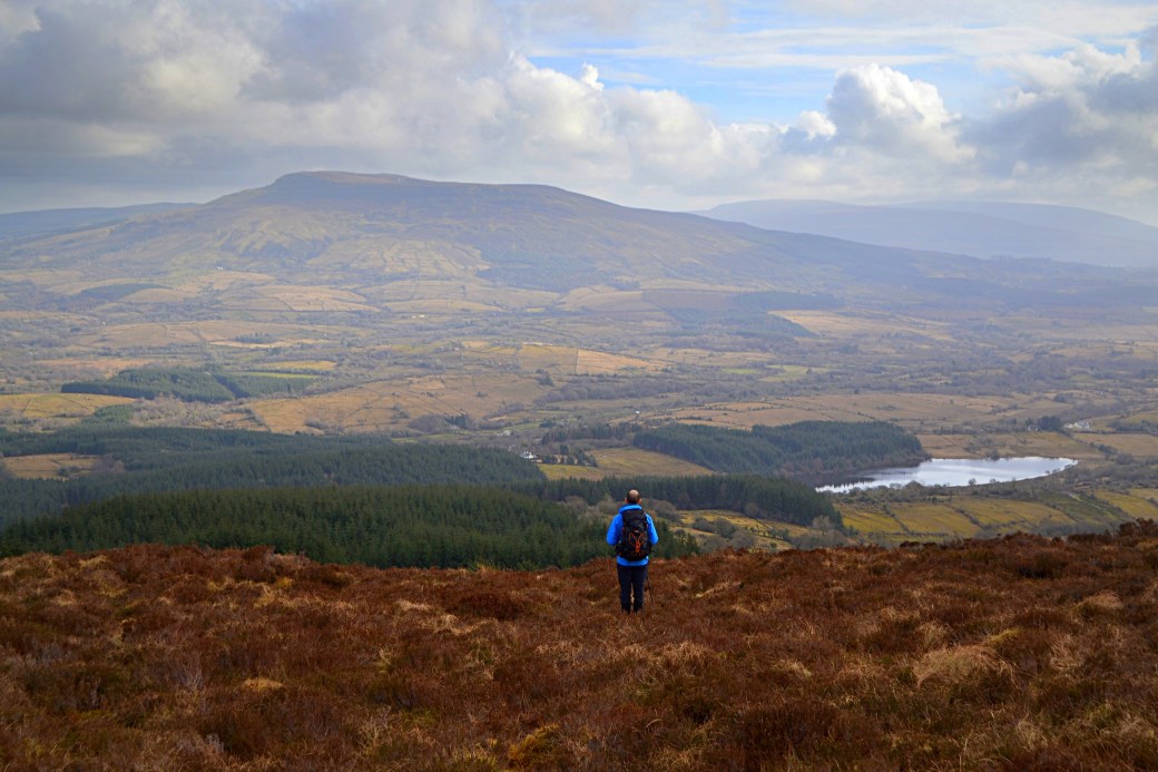
Looking across to the bulky mountain known as The Playbank or Slievenakilla on our descent
Around Slemish
I decided to fit in a hike on the Monday after Saint Patrick’s Day, when the weather finally seemed to be on the turn. Perhaps subconsciously due to the hill’s links with our patron saint, I was drawn towards Slemish in County Antrim. This most recognisable of hills marks the start or end point of the Antrim Hills Way, a route I’d walked part of last summer and had been meaning to return to.
This time I was by myself so couldn’t manage a decent linear stretch using two cars. Instead I opted for an improvised circuit beginning from the car park serving Slemish, which I’ve used a few times before to walk up the hill.
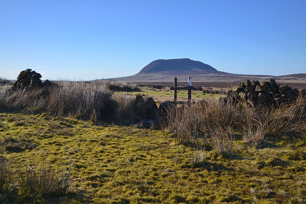
My route proved a bit aimless, with some very trying, boggy terrain but I did manage to ascend two neighbouring hills, one being Douglas Top at 402m. My photos afterwards seemed to consist mostly of Slemish taken from moderately different angles, but it is a great hill to look at.
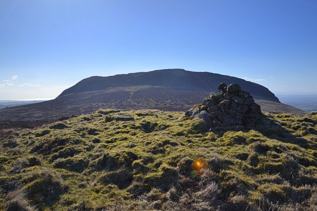
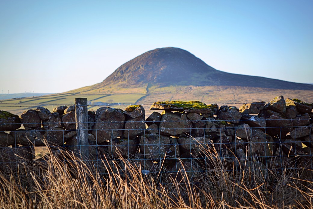
Looking back on Slemish from a lower, adjoining peak/bump called Carrigin
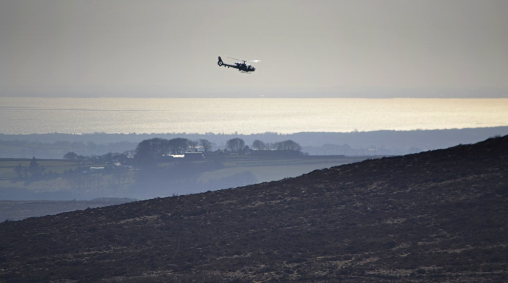
This helicopter was circling around Slemish and hovering above the bog all afternoon, probably on a training exercise; Lough Neagh can be seen beyond
Looking back on Slemish from the waymarked route
Slemish has a markedly different profile seen from locations even a short distance apart
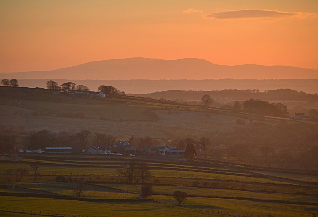
A final shot taken at sunset back at the car park, zoomed in on Slieve Gallion in the Sperrin Mountains in County Derry
Thanks to my walking companion Canice for taking three of the above images featuring me.
More info:
Cavan Burren Park website;
Naweeloge Top listing on MountainViews.ie website;
Antrim Hills Way listing on Walk NI website
You might also be interested in:
First Hike of 2018: Mullaghclogher via Father Devine’s Well |
2017: A Look Back in Images (Part 1)|
Autumn Photo Compilation |
On the Antrim Hills Way

I had noted the less frequent blogs alright!! Bit of a roundup for me too there. Some cracking pictures too. Hopefully the rest of 2018 will be as productive.
LikeLiked by 1 person
Thanks Canice, yes it’s good to look back on hikes and photos especially when it’s been a while.
LikeLike