I paid a rare visit to the Mourne Mountains in County Down at the weekend for a hike that ended up being a lot longer and more challenging than expected.
We opted for the lesser visited, and boggier, western Mournes with the aim of tackling three mountains in a loop.
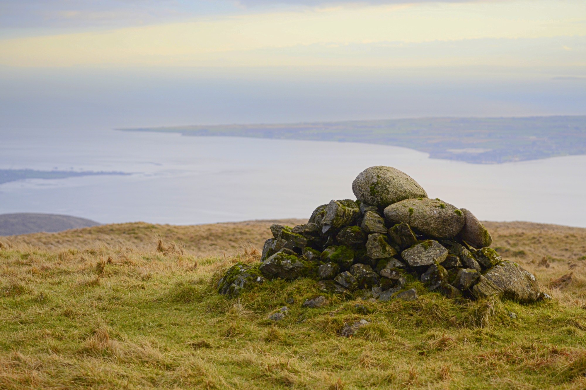
Top image: Finlieve summit cairn overlooking Carlingford Lough
Our start point was the community centre and GAA grounds just to the west of Attical village. From here we headed north along Sandy Brae and onto a track which eventually brought us to Batts Wall, a handy navigation aid just like the more famous Mourne Wall. A steep trek uphill took us to the summit of Eagle Mountain (638m), where we had lunch in the shelter of the wall.
A brief walk with little height loss took us to our next target, Shanlieve (626m). Conditions changed abruptly here with the clouds closing in until we could see only a short distance in front of us. This led to us going well off course on an already long, boggy and tiring hike to Finlieve (578m). This peak, the only one of the three I’d yet to tick off on Mountainviews.ie, was easily accessed via a short climb from a welcome track and offered some stunning views in the evening light.
We headed downhill via the long track but, owing to some well meaning but ropey advice from a passing local, opted to cut cross-country back to our start point. This took some distance off our route but ended up being a lot more awkward, muddy and prickly than we’d been led to believe. It was well after 7pm and pitch black by the time we reached the car with the help of our head torches.
Below are some of the sights from a day in the hills that had its fair share of ups and downs.

Stone walls and shapely summits seen from Sandy Brae, a dead end road leading into the mountains
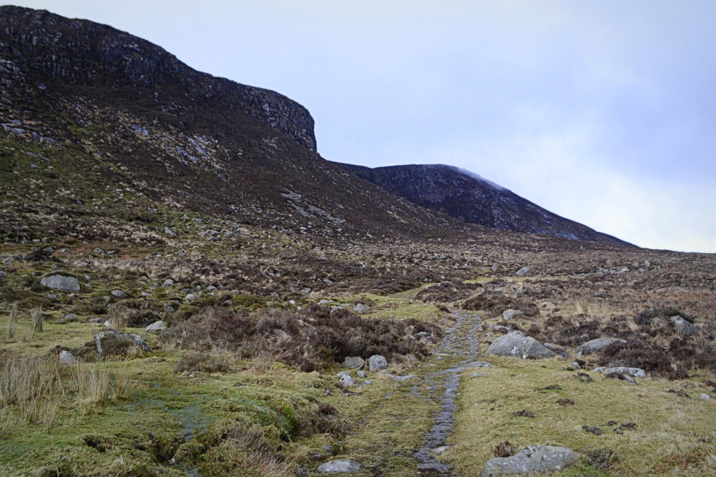
Following the track up to Batts Wall, with a line of steep cliffs on our left
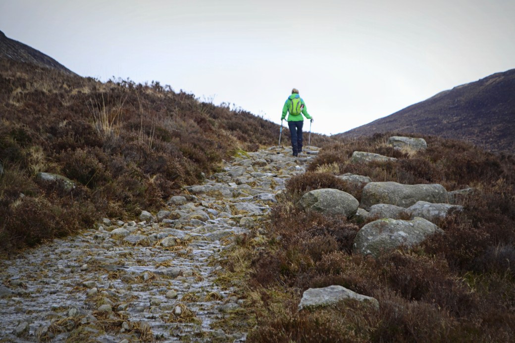
Mags making her way up the track which at times was more like a river
A backwards glance before we reached Batts Wall; on the right in the distance are lowly Aughrim Hill and Knockchree

Looking over Batts Wall towards the twin-topped and unfortunately named Cock Mountain; its craggy, lower sibling Hen Mountain can just be seen to the left

Eagle Mountain’s summit cairn, with some of the central Mournes peaks beyond
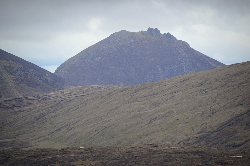
A zoomed in shot of mighty Slieve Bearnagh and its granite summit tors, taken close to Eagle’s summit

Slieve Donard, the daddy of the Mournes, with a good dusting of snow
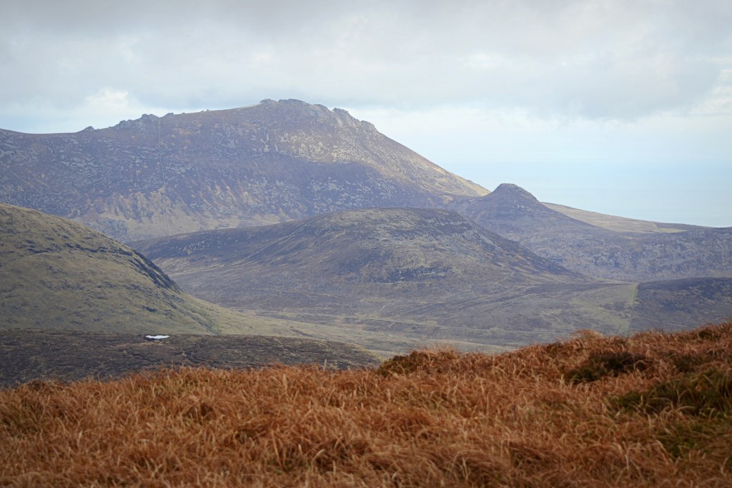
Rocky Slieve Binnian with its smaller sibling / parasitic appendage Wee Binnian on the right
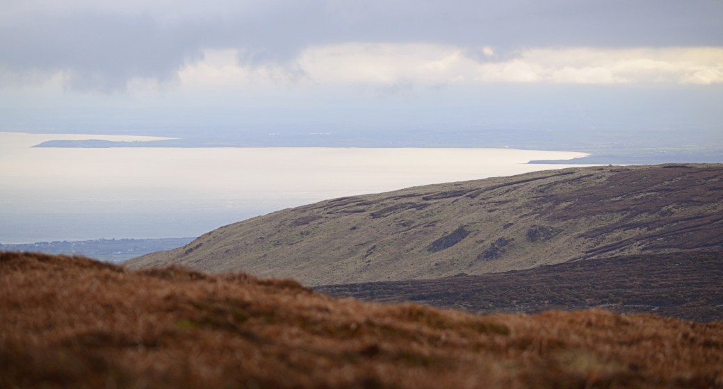
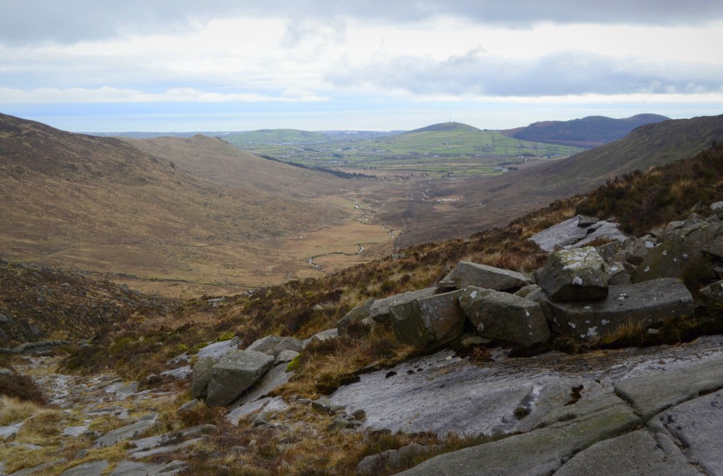
A view down Ireland’s east coast just before leaving Eagle Mountain; the prominent fingers of land are Clogher Head on the left and Dunany Point on the right, both in County Louth
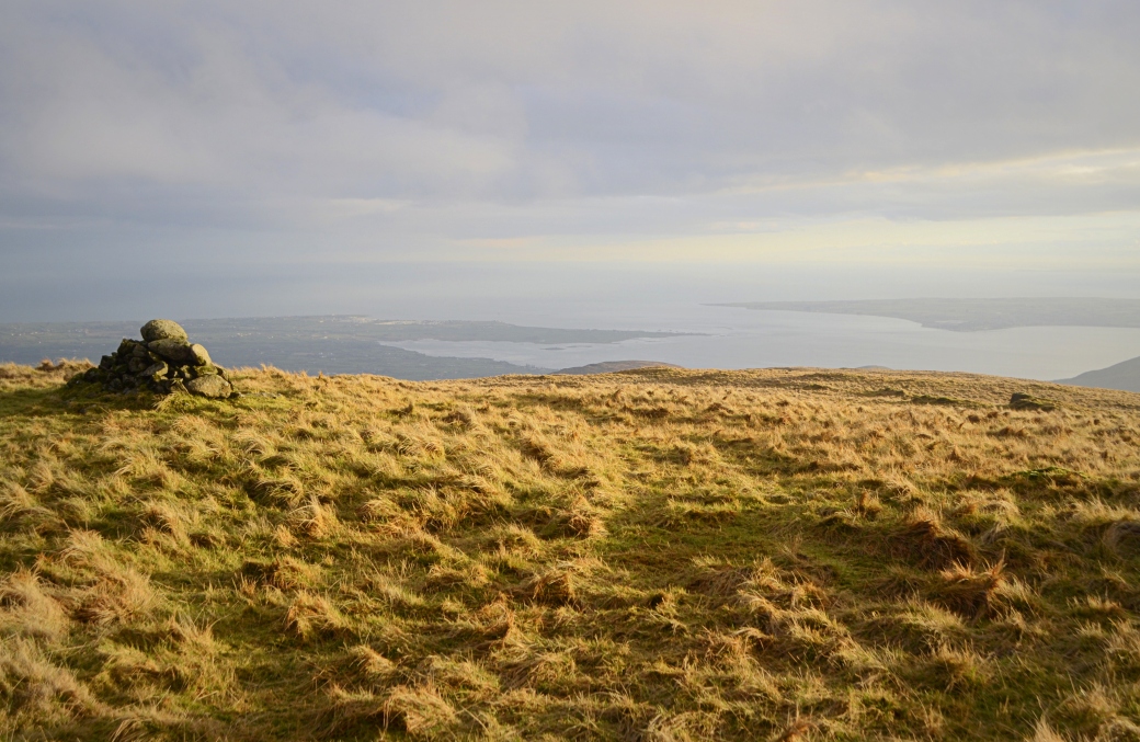
The summit of Finlieve gave a unique and stunning perspective over Carlingford Lough: County Down culminates with Cranfield Point on the left with the eastern end of Louth’s Cooley Peninsula on the right
Total distance: 18.3km / 11.4 miles
Map: OSNI Mournes Activity Map
Some of my earlier posts you might be interested in:
Slieve Beagh: Three Counties and Countless Frogs |
Sligo: The Caves of Kesh / Keshcorran |
Sperrins Photo Blog: Vinegar Hill Loop

Interesting to note the lack of snow compared to the west. Was wading through it in places on Sunday. Must try that route sometime, I’m not familiar with that side of the Mournes. But I’ll bring the compass and head torch just in case!!
LikeLiked by 1 person
Not sure you’d ever want to do this exact route! There was a good bit of snow on Donard, judging from people’s photos on Facebook. Definitely worth visiting this less known end of the range.
LikeLike
Great stuff Martin, and some brilliant views there. I haven’t done any of those three. Those trying days are sometimes the best to look back on and enjoy the memory of your trials safe in the knowledge that they’re over 🙂
LikeLiked by 1 person
Cheers Aidy. I like that end of the Mournes as it’s quieter and you get great views across the lough. Was hell for much of it but there’s nothing like finally reaching the car and putting on a fresh pair of socks 🙂
LikeLiked by 1 person
When you reach batt’s wall for eagle ( is that between eagle and Moughanmore?) did you stay on that side and ascend eagle or cross the style and walk up the right side? Also from eagle to Shanlieve did you stay on the left or right of the wall again? Left being the side the summitcairn is on on eagle.
LikeLike
Hi Jenny, it was a few years ago so I’m a bit hazy but yes we met the wall between Eagle and Slievemoughanmore. We stayed on that side of the wall, you can see our view looking over it in one pic. I think we stayed on that side going onto Shanlieve too.
LikeLike
Ok fab. Just wasn’t sure which side and if any cliffs? Does the wall lead directly to Shanlieve summit? I did hen cock pigeon and Moughanmore on mon and looked across to eagle so might do Moughanmore eagle and Shanlieve soon. Just wasn’t 100% on the route as eagle is one of the very few I hadn’t done
LikeLike
No, it was pretty straightforward (though quite steep if I recall) along the wall to Eagle. No cliffs on that stretch and it took us straight to the summit which is on that side of the wall (just had a look at the OS map). Enjoy the hike.
LikeLike