
I visited the Mourne Mountains at the weekend to get some practise in for a challenge hike I’m doing next month.
The Blackstairs Challenge is a 31km route over the Blackstairs range in Ireland’s southeast. The Mournes are an ideal training ground, with their steep ascents and descents and endless options for longer walks.
Top image: A view of Slieve Bearnagh and layers of summits beyond taken from Slieve Commedagh
My original plan was to start from the car park serving the Trassey Track, one of the main access points into the higher peaks. This leads to Hares’ Gap from where I would follow the reliable Mourne Wall along the ridge line all the way to Slieve Donard, the tallest mountain in Ulster at 850m. My return would be on lower ground via the trail known as the Brandy Pad, once a smugglers’ route from the coast to the inland valleys.
I started late in the day though and the car park was full, with loads of cars parked along the narrow Trassey Road and people out making the most of the sunny weather. Wanting to avoid the crowds, I drove on to the next car park further west along the road. This serves the twin summits of Slieve Meelmore and Slieve Meelbeeg via a steep and boggy approach and thankfully still had spaces.
It was only when I reached my first peak, Slieve Meelmore that I decided on a revised route after surveying my surroundings.

Looking south from the summit of Slieve Meelmore, with the Mourne Wall and Slieve Binnian on the left and Silent Valley Reservoir in the distance
I headed down steep, stony ground to meet a track running along the northern base of Slieve Bearnagh and past a quarry towards the top of the Trassey Track and Hares’ Gap.
From there, I reversed my original plan by following the Brandy Pad outwards and then returning by the higher ground. I didn’t make it as far as Slieve Donard as time wasn’t on my side but was content with Slieve Commedagh, the second highest peak in the range. When I got to the bottom of the Trassey Track, I followed a boggy section of the Mourne Way running parallel to the road to bring me back to the car.
There was a lovely light on the summits in the late evening and I enjoyed walking the Brandy Pad as the entire section beyond Hares’ Gap was new to me. I didn’t stop for many photos as I was conscious of time but here are some more of the sights.
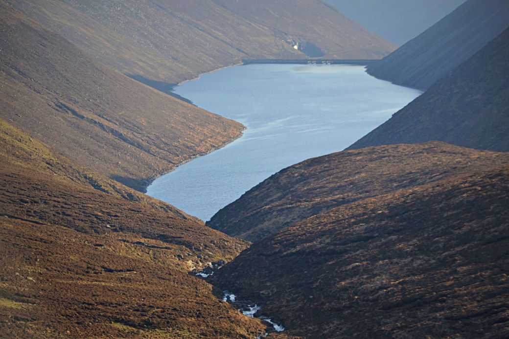
The Brandy Pad gives an excellent view over Ben Crom Reservoir
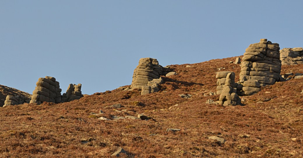
Looking up at part of The Castles, a line of cliffs and rocky tors between the Brandy Pad and the higher summits
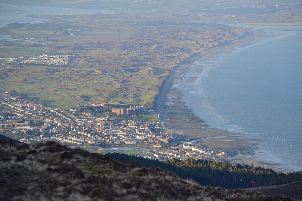
The classic view over the seaside town of Newcastle and Dundrum Bay taken from the col between Donard and Commedagh; you can see the Slieve Donard Resort and beyond, the dunes of Royal County Down Golf Club
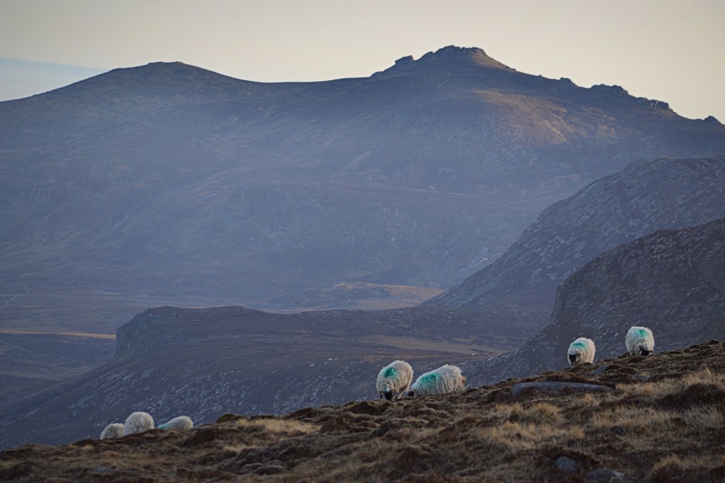
A view of Slieve Binnian taken on my way up Commedagh

Another view of Ben Crom Reservoir and its surrounding peaks taken near the summit of Commedagh
Here’s an aerial video map of my route made using the Relieve app.
Total distance: Probably around 18km/ 11 miles (my GPS played up for a couple of stretches)
Total time: Approx. six hours
Map: OSNI 29 or ideally Mournes Activity Map
More info: Trassey to Bloody Bridge listing on WalkNI (entire Brandy Pad route)
Some earlier posts you might enjoy:
Hikes of 2018: January to March Round-up |
Autumn Photo Compilation |
Mournes Hike: Eagle, Shanlieve and Finlieve

How lucky were you with the weather? Some lovely pics there. Nice to see the tops when they aren’t cloaked in mist.
LikeLiked by 2 people
Thanks Canice. Yeah the weather was perfect, especially later on. Don’t think I’ve ever seen the view so clear going up Commedagh/Donard.
LikeLiked by 1 person
Don’t know how I missed this post! Agree with Canice, so lucky with the weather, the views are brilliant!
LikeLiked by 1 person
Thanks Ashley, yes you can’t beat those gorgeous spring evenings. At least we#re on the right side of the winter solstice now!
LikeLiked by 1 person
Really beautiful photos and stunning views. Air must have been crystal clear.
LikeLiked by 1 person
Only seeing this! Yes was a beautiful spring afternoon/evening as I recall. The Mournes are stunning and very accessible.
LikeLike