
I visited Edinburgh for a weekend at the end of April to visit friends and managed to fit in some great walks in the city and surrounding region.
It’s long been one of my favourite cites and a big part of this is its easy access to the outdoors (helped by the hilly topography) and abundance of interesting and scenic places to visit nearby.
Top image: The Union Canal at Polwarth Parish Church
This time, my walks were on fairly level ground, taking in the initial (or final) part of the Union Canal, about half of the Water of Leith Walkway and a short section of the Fife Coastal Path, the latter on the opposite shore of the Forth of Firth from Edinburgh.
First, a couple of ‘plane pics’ from my short flight over from Belfast.

The village of Portpatrick on the Rhins of Galloway; I really enjoyed visiting it on a cycle tour back in 2015
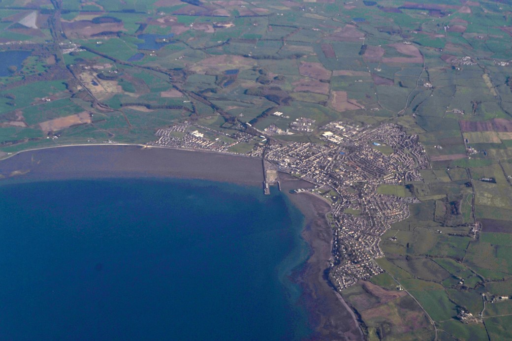
The town of Stranraer and Loch Ryan
My friends were busy during the day on Saturday and I decided to do some exploring, also conscious of the need to keep up the training for the upcoming Blackstairs Challenge in the southeast of Ireland. I decided to walk to the suburban village of Balerno, first of all following the Union Canal and then the leaving it to join the Water of Leith Walkway.
Reopened in 2001, the Union Canal connects Edinburgh with the town of Falkirk to the west, running for a distance of 50kms / 31 miles. From there it links up with the lower level Forth and Clyde Canal via the iconic Falkirk Wheel rotating boat lift and an aqueduct, the latter waterway travelling onwards to the far side of Glasgow.
I only walked along the canal for a short distance, starting from its terminus at Lochrin Basin close to the city centre. I really enjoyed its peacefulness and changing views though and would like to explore more of it. It’s a great amenity running through the city and its suburbs and was busy on the day with walkers, joggers, cyclists and rowers.

Barges seen near the start of my walk

A glimpse of the Pentland Hills in the distance
The canal’s ‘junction’ with the Water of Leith is signed from the path and I followed the steps downwards to the latter. The Water of Leith Visitor Centre is located at this point, in a renovated schoolhouse, and offers an exhibition and refreshments. The river is Edinburgh’s most significant, rising in the Pentland Hills and flowing to the west and north of the city centre to enter the Firth of Forth at the port of Leith. The Walkway runs for about 21kms /13 miles altogether.
My route southwestwards to Balerno crossed the river multiple times and it was often unclear what side or path you should be on, though you’re never going to get too badly lost. The surroundings were a mixture of quiet woodland and suburbia, with a welcome glimpse of fields and grazing sheep towards the end. I did enjoy the walk but if I had to choose, I would probably opt for the more open views along the canal.
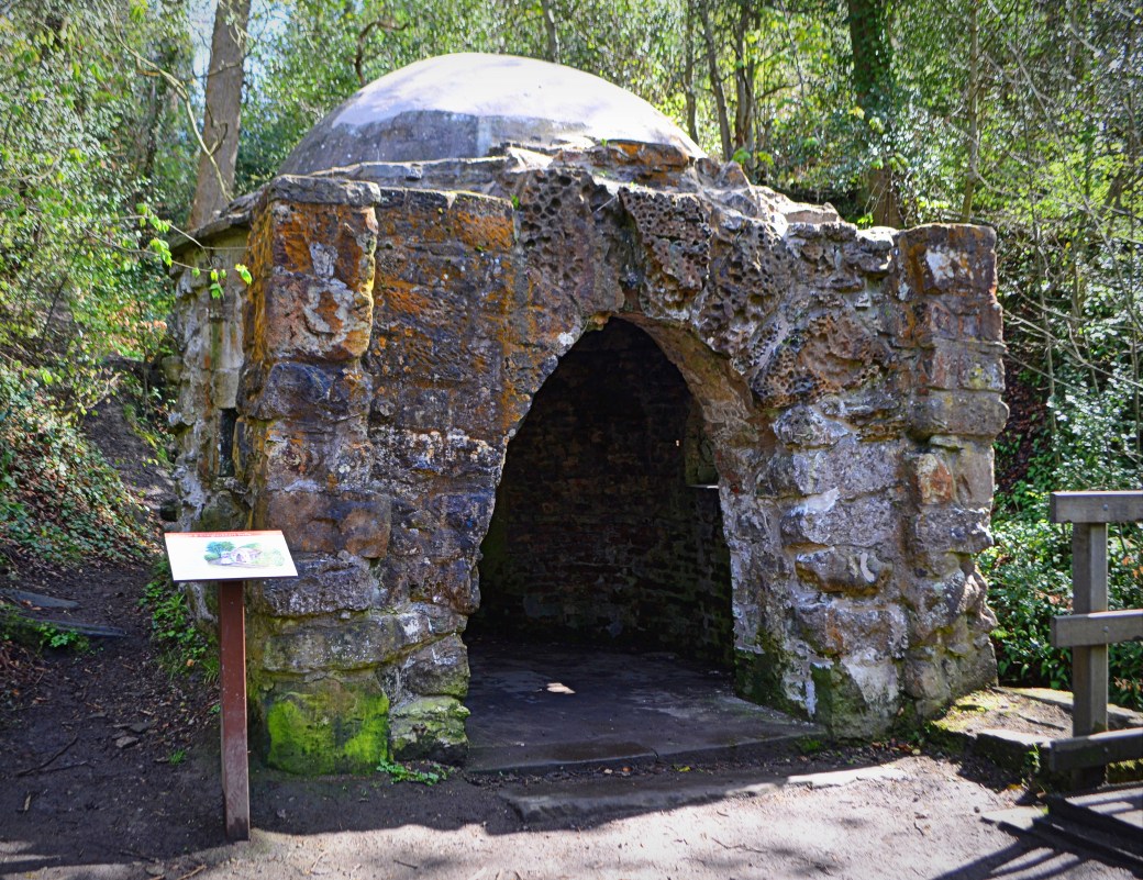
A ‘grotto’ along the banks of the river, in the former Craiglockhart Estate; they were used by visitors as a place to rest while walking through the estate but remind me of mini Orthodox churches seen in the likes of Serbia


A scenic bridge and weir near Colinton Village

Directional sign at Colinton
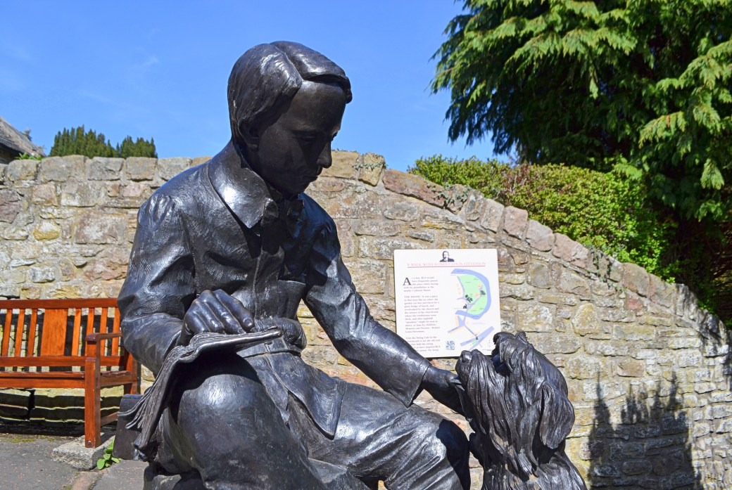
I made a slight detour to visit this sculpture of a young Robert Louis Stevenson; the Edinburgh-born writer’s grandfather was minister here in Colinton

Approaching Balerno at the end of the walk

St. Mungo’s (Anglican) Church, Balerno

Balerno’s handsome but short and very quiet main street (at 5pm on a Saturday, anyway)
I’ll add another post soon with some photos from the Fife Coastal Path.
As usual these days, I recorded an aerial video map of my route using the Relieve app.
Total distance: 16km/10 miles
Total time: Approx. 3.5 hours with plenty of stops
More info: www.scottishcanals.co.uk/canals/union-canal | www.waterofleith.org.uk/walkway
Some earlier posts you might be interested in:
Hills of Edinburgh: Calton Hill and Blackford Hill |
Cycling in Galloway, Scotland: Photo Blog (A Year Late)

Looks like you had another very pleasant trip. The pictures look so tranquil considering the close proximity to Edinburgh.
LikeLiked by 1 person