
I’ve been neglecting this blog once again so thought I’d post some photos from a couple of recent hikes in the Sperrin Mountains.
The first was part of the Omagh and Sperrins Walking Festival and led by outdoors adventure providers Far and Wild.
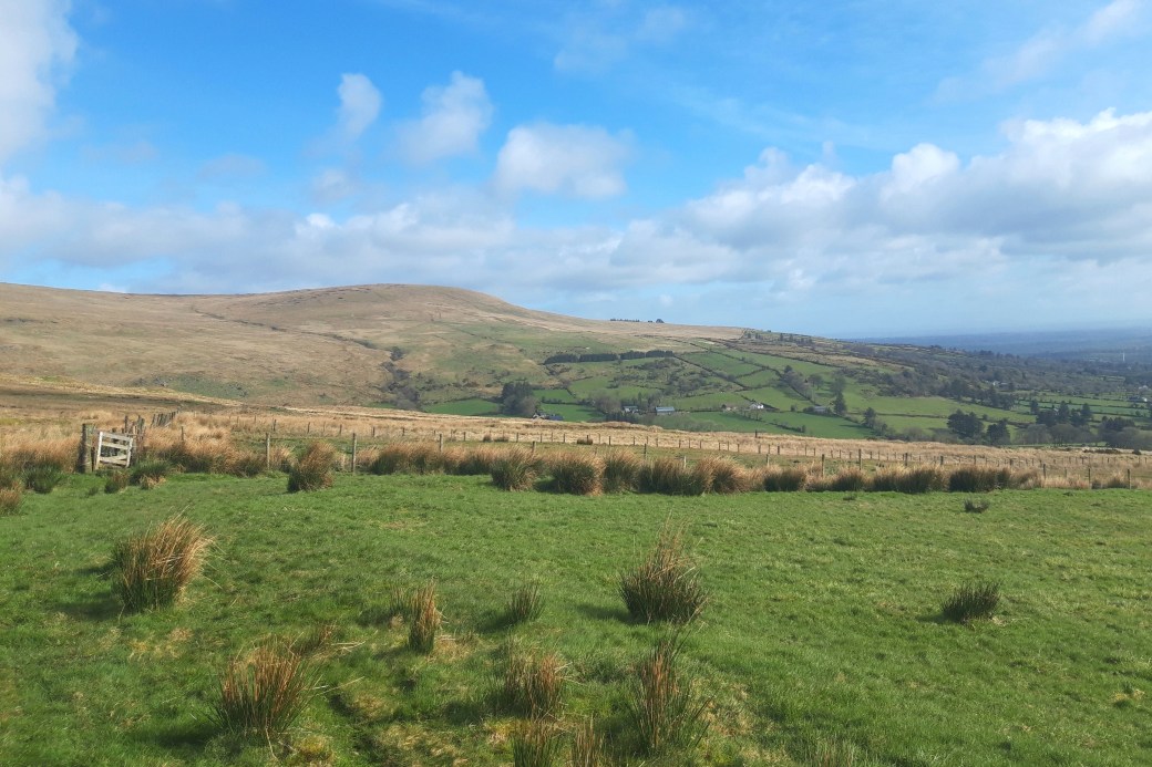
Top image: Our group descending the summit of Carnanelly with a view westwards along both sides of the Glenelly Valley
A challenging hike over typically wet and boggy Sperrins terrain, it sought to recreate part of the route of a key event in Irish history, the Flight of the Earls in 1607.
This episode involved the fleeing of the Ulster chieftains, defeated and diminished in both land and prestige at the hands of the English, and signalled the end of the old Gaelic order. It was the precursor to another pivotal event, the Plantation of Ulster, when Ireland’s northern province was settled by Protestants from Scotland and England.
The noblemen, foremost of whom was Hugh ‘The Great’ O’Neill, passed through the Sperrin Mountains along with their families and entourage en route to Rathmullan on Lough Swilly. From there they sailed to mainland Europe in the hope of raising an army to invade Ireland with Spanish help, but this never happened and they remained in permanent exile.
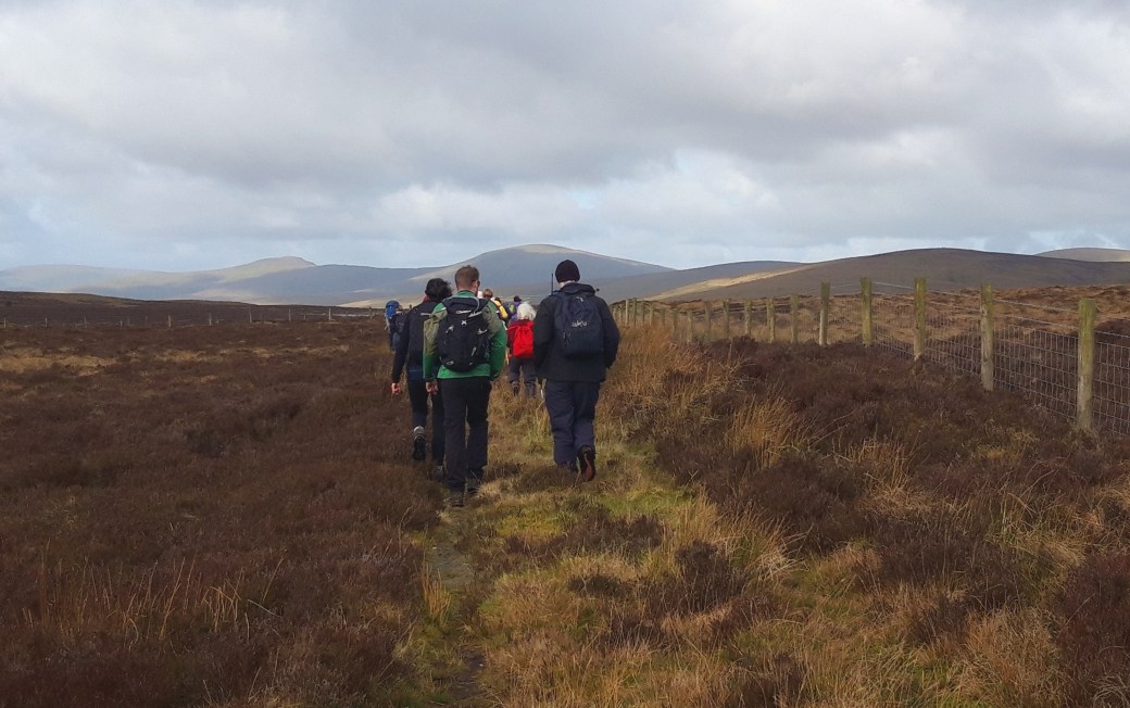
Our route started at the eastern end of the Glenelly Valley, initially following an old track up into the hills on its southern side which our guide Lorcan speculated might even have been used by the earls.
Ascending into the hills and already there was a great view; you can clearly see where the Sperrins meet the lower ground towards Draperstown to the east
His thinking that they passed through this part of the Sperrins was influenced by the fact that O’Neill had endowed a church a short distance below our route and so was likely to have stopped there on his way to Lough Swilly.
A welcome gentle section approaching Lough Ouske, with the higher peaks of Dart and Sawel beyond
After getting onto the higher ground, we passed just above little Lough Ouske and then walked up to the summit of Carnanelly, the highest peak on the southern side of the valley. From there we continued downhill and westwards to eventually meet the lonely road heading north into the High Sperrins from Broughderg.
All these photos from the day were taken on my phone, seeing as I left my ‘good’ camera at home.
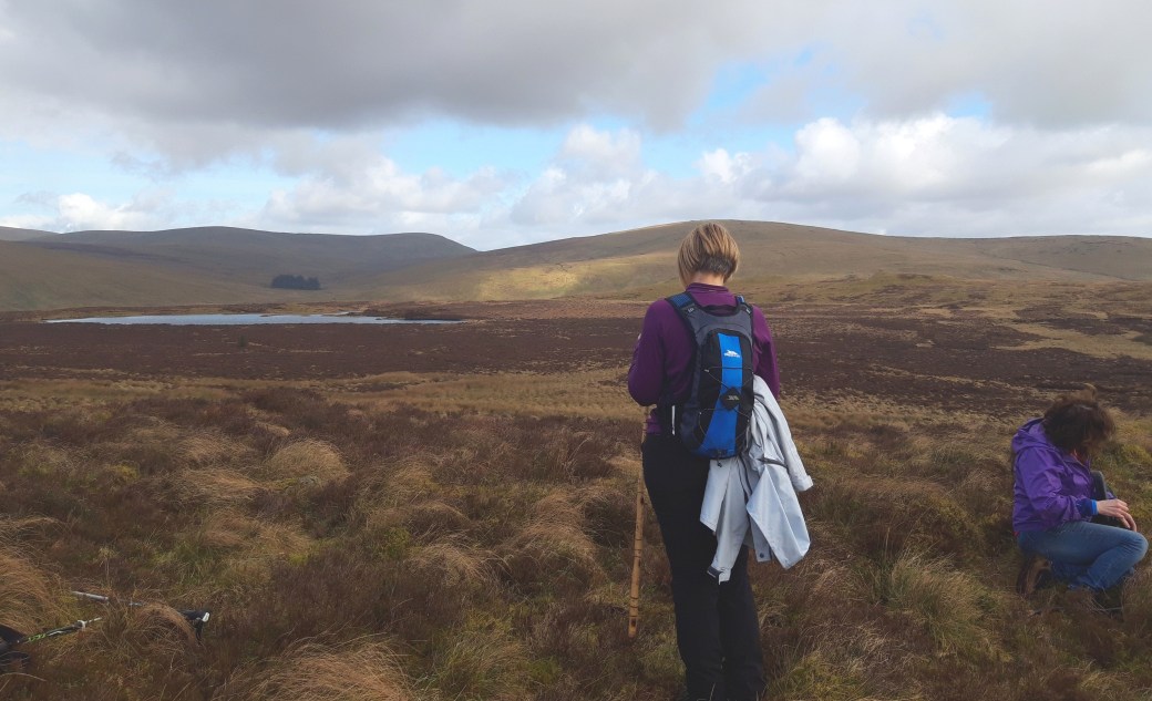
A rest stop overlooking Lough Ouske, which straddles Counties Tyrone and Derry. Could the earls have camped overnight beside this hidden mountain lake?
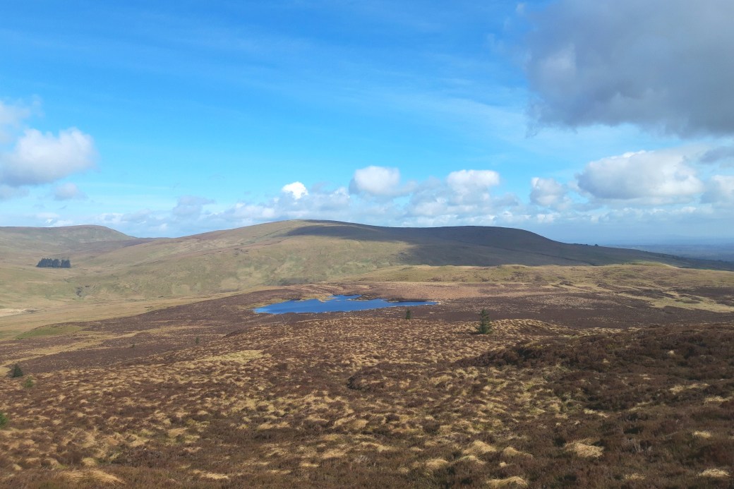
Looking back on Lough Ouske, with the summit of Crockbrack beyond
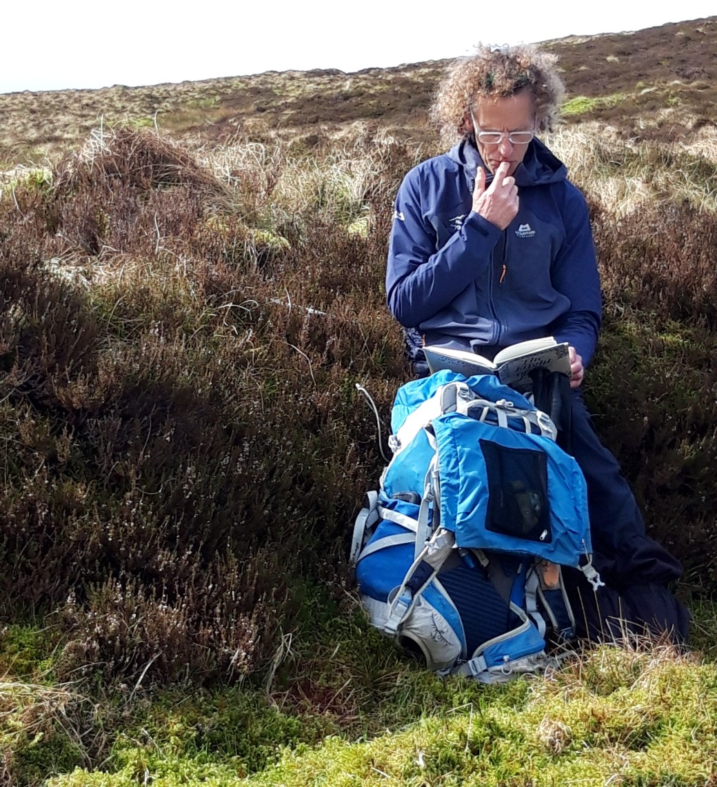 Our guide Lorcan brushing up on his history; the book is The Flight of the Earls by Liam Sword


We had lunch just below the cairn near the summit of Carnanelly

A lovely, secluded section through forest and along a stream towards the end of the hike

Back on firm ground as we walked downhill to meet our bus
As usual, I generated an aerial video map of our route using the apps Strava and Relive.
Total distance: 14.6km / 9.1 miles
Map: OSNI 13 or Sperrins Activity Map
Some earlier posts on hiking in the Sperrins:
First Hike of 2018: Mullaghclogher via Father Devine’s Well |
Snow in the Sperrins, Christmas 2017: Mullaghsallagh |
Photo Blog: Vinegar Hill Loop

First post in a long while. A nice reminder of a very pleasant day. The pictures came out well.
LikeLiked by 1 person
Thanks Canice, yes it was a great day out.
LikeLike