
I stayed close(ish) to home for my final hike of 2016, with another visit to the Sperrins in my native Tyrone.
We chose a linear route on the southern side of the Glenelly Valley, starting with a visit to Lough Ouske, one of the biggest bodies of water in the range.
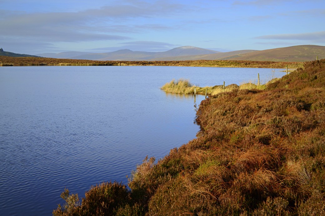
Top image: Canice enjoying the view across Lough Ouske
We met and left one car at our end point, just south of tiny Lough Lark on the lonely mountain road running through the eastern end of Glenlark Forest; there’s space to park at H646925, just above a gate across the road. From here we drove the other car north towards the main road through the valley, admiring the views but wary of the turns and sharp drops from the minor road.
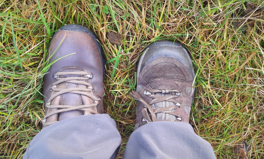
Our hike began at Leaghs Bridge, a little west of the county boundary, where’s there’s also space to park. It was here that I realized the day would be an ‘interesting’ one: when I’d left the house I’d inadvertently picked up two completely different boots. One wasn’t very waterproof but on the positive side I had both a left and a right!
A short walk eastwards along the main road brought us to a gate and track on our right, marked on the map. The views soon opened up over the valley as we ascended and passed a small agricultural pen.

View westwards along the valley, with Dart Mountain poking up on the right
We veered off to the right, aiming for a fence higher up the hillside. When we met it, it brought us right to Lough Ouske. We spent some time taking in the views of the irregularly shaped lake. I’d seen it many times from the surrounding mountains (there’s an image of it in my post on the Crockbrack Way) so it was great to finally see it up close.

We decided to do an arc of the lough before continuing on our way. We crossed two fences and into County Derry briefly, following the shoreline west. The ground was very wet on this side, not much fun without gaiters and with one non-waterproof boot.The views made up for it though: from this side the twin peaks of Dart and Sawel form a backdrop as you look across the lough.
We continued around to the far (north) shore of the lough then followed the fenceline running southwest as it ascended towards the summits of Slieveavaddy and Carnanelly. The terrain got dryer as we rose and the views expanded: back over Lough Ouske, with the mountains on the northern side of the valley beyond, and the long bulk of Slieve Gallion to the southeast. The latter has unfortunately acquired new wind turbines on its western slopes.

Looking back on Lough Ouske, with Crockbrack and Crockmore beyond
Goles Forest and Carnanelly on the left, Dart and Sawel on the right
When Carnanelly came into view, we aimed for the corner of Goles Forest. From there it’s a slow climb up the mountain along the forest edge, with the not-quite-summit cairn visible early on.

We had lunch just below the cairn, where I took the opportunity to empty my boots of water. The surroundings looked completely different from the last time I was up there, back in November in heavy snow.

The cairn near Carnanelly’s summit, with Lough Ouske still visible on the right
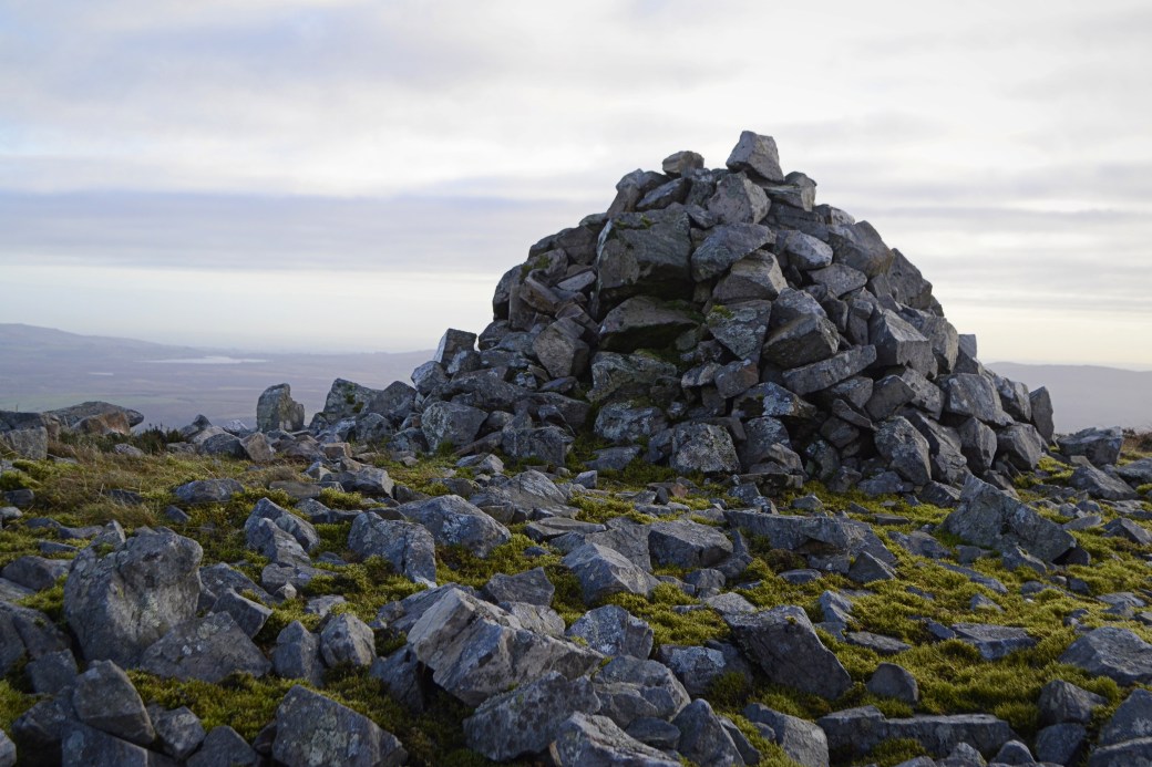
Close-up of the cairn with Lough Fea near Cookstown in the distance on the left
We set off uphill a little further towards the proper summit, marked by small rocky outcrops. It was nearly all downhill now, with a barely noticeable rise to reach Carnanelly’s West Top. From here, we could see the remainder of our route below us: a wide gap through a protrusion of Glenlark Forest marking the course of Feighatan Burn.

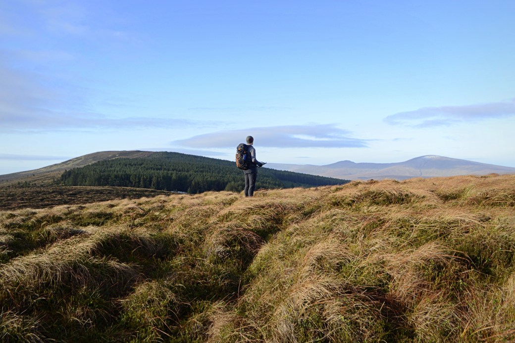
Heading for the gap in the forest, which can be seen in the centre of the shot
The walk through the forest was slow going, with uneven ground and heavy rushes close to the stream. This section isn’t too long though and we eventually met a path which brought us to the gate beside our waiting car.

Total distance: 9.2km / 5.7 miles
Map: OSNI 13 or Sperrins Activity Map

Loved this Martin – haven’t really walked that corner of the Sperrins yet, but definitely recognise the typical Sperrin scenery from your photos. You’ve captured the essence of them there.
LikeLiked by 1 person
Thanks Aidy, glad you liked it. There’s definitely something special about the Sperrins, even though the terrain can be hell. There are some good walks at that end. You get a class view of Dart, Sawel etc. from Carnanelly.
LikeLike
I’ll definitely have to get out that way. The nearest I’ve been on would have been Clogherny Top and Spaltindoagh, and I really enjoyed those walks. I agree, the Sperrins are kind of unique.
LikeLiked by 1 person
I actually googled Spaltindoagh there as I did it years ago and wouldn’t mind returning, I see your MV comment! Great day you got. There’s something appealing about those remote places that few people ever visit.
LikeLike
A beautifully written account of an equally beautiful hike. Had forgotten about the swampy section though. Something nice about the pics, can’t quite put my finger on it!!
LikeLiked by 1 person
Thanks Canice. Yes the swampy section was hell. I agree about the photos… think it’s the winter light!
LikeLike