
I revisted my ‘locals’, the Sperrin Mountains, recently to walk a circuit I’d first troddden several years ago.
Altbritain Forest is a southerly offshoot of the huge Banagher Forest and runs most of the way up Mullaghaneany, the third highest peak in the range at 627m.
Top image: Looking down over Altbritain and Banagher Forests on our descent from Mullaghaneany
Our route took in this mountain and three lower peaks surrounding the forest. These were Craigagh Hill, Spelhoagh and Oughtmore, the first two of which are located in County Derry while Oughtmore and Mullaghaneany sit on the border between Derry and Tyrone (confusingly, there is another, less tall Oughtmore further south in the Sperrins, near Davagh Forest).
We parked off the B40 Draperstown/Moneyneany to Feeny road at H7258997, just past a bad bend, beside an information panel on the geology of the Sperrins. From here we walked west along the road before taking the second of two rough tracks on our left, which led almost to the summit of Craigagh Hill. From here we followed our circuit in a clockwise direction to Mullaghaneany, before descending into the forest and back to the start along the road again.
It’s an enjoyable circuit because it’s easily accessible, with handy navigation aids in the ridge fence and the distinctive two-pronged forest to your side (in our case on our right). Besides a couple of short steep sections around Craigagh Hill and the long pull up Mullaghaneany, the going is generally easy enough.

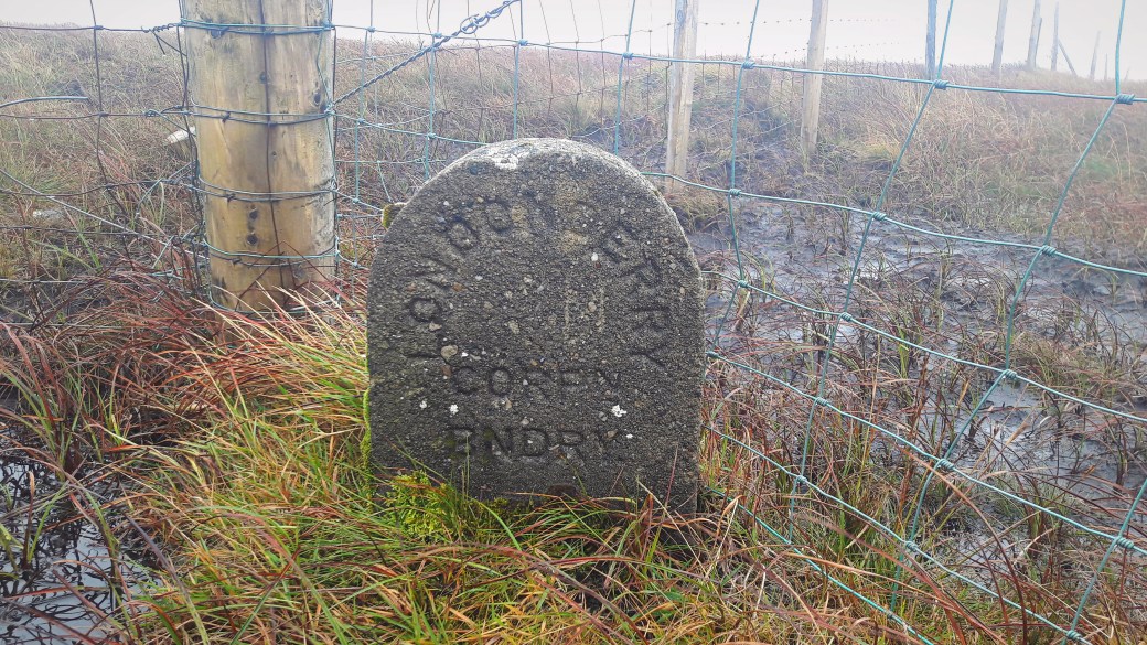
These eye-catching marker stones were a recurring sight on our route. They mark the boundary of the old (and controversial) Londonderry Corporation. It existed from 1613 until it was abolished in the late 1960s, and preceded the modern city council.
As is often the case in the Sperrins, the views from them more than make up for the boggy and aesthetically nondescript hills themselves. The last time I did this route I remember an early vista of County Donegal in one direction and County Louth in another, or right across the northern part of Ireland.
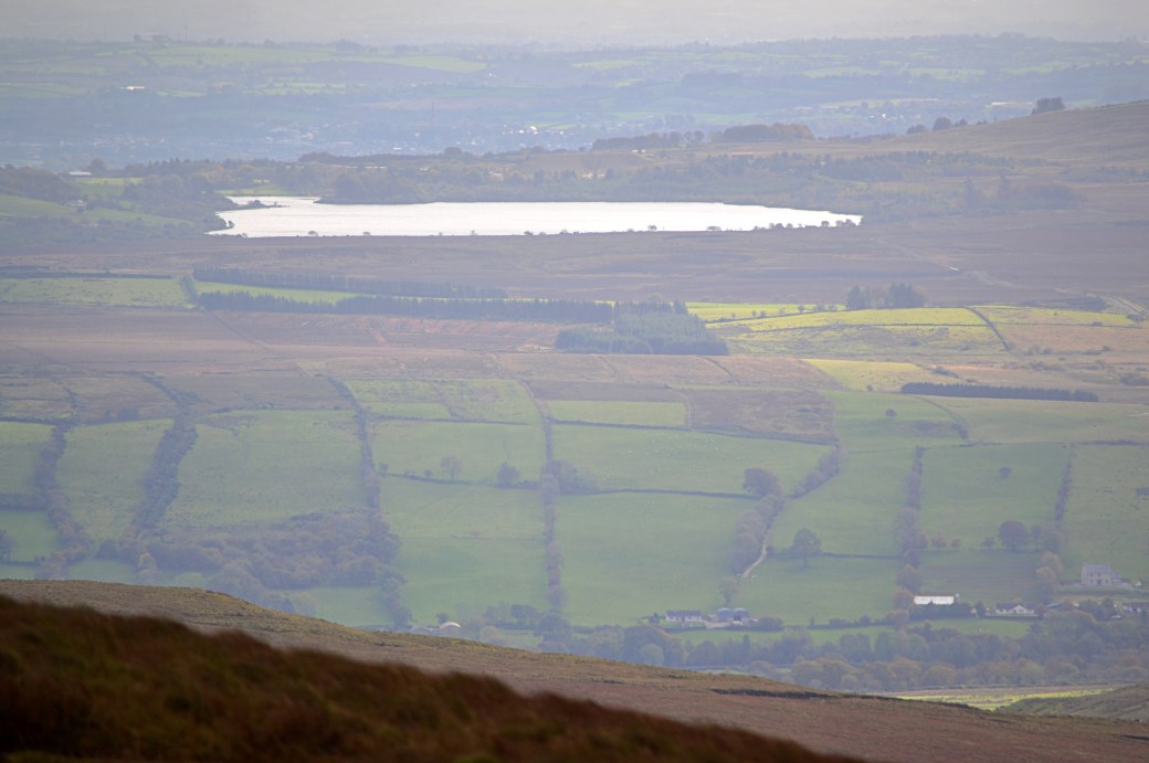
The views weren’t quite as far reaching this time but we still enjoyed fine views across Mid Ulster and Lough Neagh on one side and northwards across Banagher Forest to the more striking summits of Benbradagh and Binevenagh. To the left of the latter, Inishowen could be clearly seen on the opposite shore of Lough Foyle.

An early view southeast towards Slieve Gallion
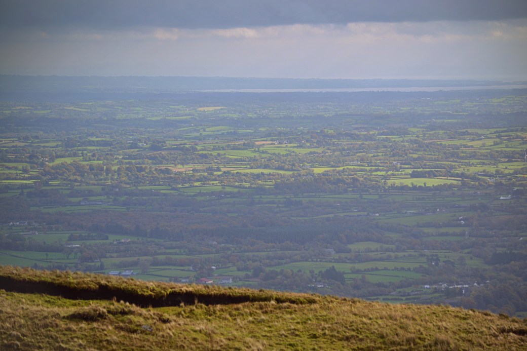
Looking down over the lowlands of South Derry towards Lough Neagh and County Antrim beyond
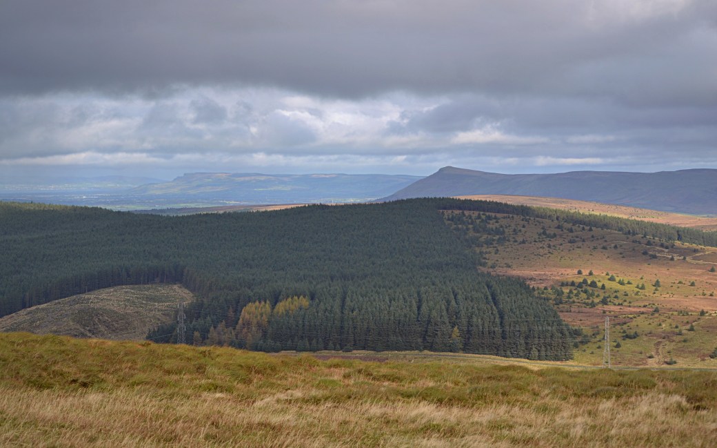
Looking across Banagher Forest to Benbradagh and to the left, Binevenagh. Inishowen is just visible in the distance across Lough Foyle.
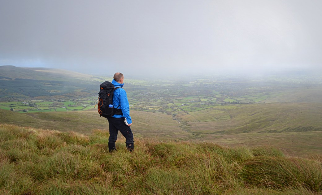
Canice taking in the views to the east of the ridge
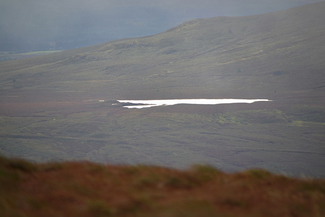
A zoomed in view of the secretive Lough Ouske, part in Derry and part in Tyrone, on the far side of the Glenelly Valley. I visited it on a previous hike.
The larger and further away Lough Fea
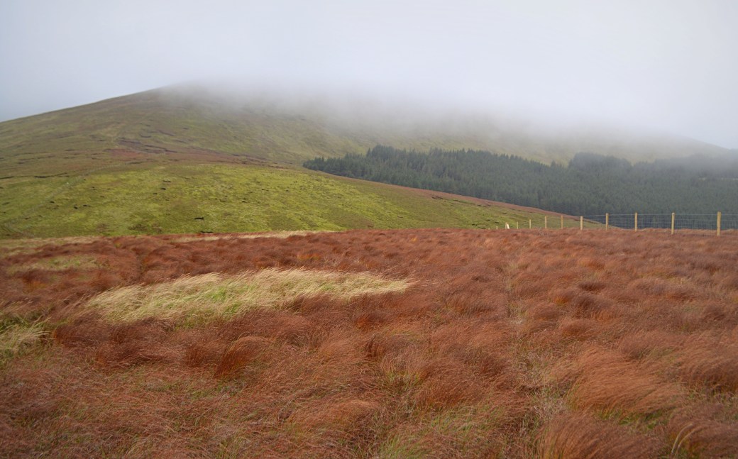
Mullaghaneany topped by cloud, with part of Altbritain Forest on the left
Another boundary stone adds some interest to Mullaghaneany’s boggy summit
View an aerial route video of this hike using the Relive app.
Total distance: 12.5km / 7.8 miles
Map: OSNI 13 or Sperrins Activity Map
More info: Listings for Craigagh Hill, Spelhoagh, Oughtmore and Mullaghaneany on Mountainviews.ie
Earlier posts on hiking in the Sperrins:
Sperrins Photo Blog: Vinegar Hill Loop|
Sperrins in the Snow: Carnanelly |
Crockbrack Way (and a bit of Hudy’s Way)

Nice recap of a very enjoyable hike. I like how you framed the first boundary picture with the rusty iron posts. Nicely written as usual.
LikeLiked by 1 person
Cheers Canice, definitely an enjoyable route
LikeLike