
On the way home from my recent trip to County Donegal, I veered off at Strabane to tackle a little known hill that had been on my radar for years.
Although relatively modest in height at 296m, shapely Knockavoe dominates the town to the east and promised wide-ranging views over Tyrone and Donegal.
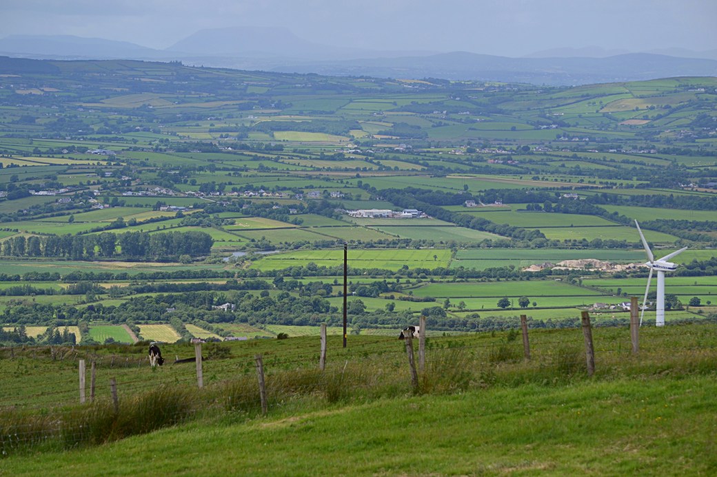
Top image: Looking down on Strabane (and to the right, Lifford) on my descent
The hill sits at the western end of the Sperrin Mountains, a final outlier before the range tumbles down to the River Foyle. I’d visited the surrounding countryside before and it always surprises me how steeply the ground rises (and how narrow the roads get) once you head east out of Strabane.
Out of a number of possible approaches, I opted to start from the northwest side of the hill, via a track leading off the Curlyhill Road. In short, this proved to be a poor decision, with a few tricky fences en route to the summit, and I wouldn’t recommend this approach. One benefit, though, was the early views over the wide and winding Foyle to northwest.
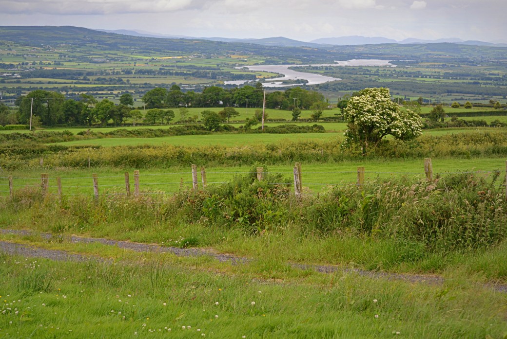
View over the River Foyle on my ascent, with Donegal on the far side
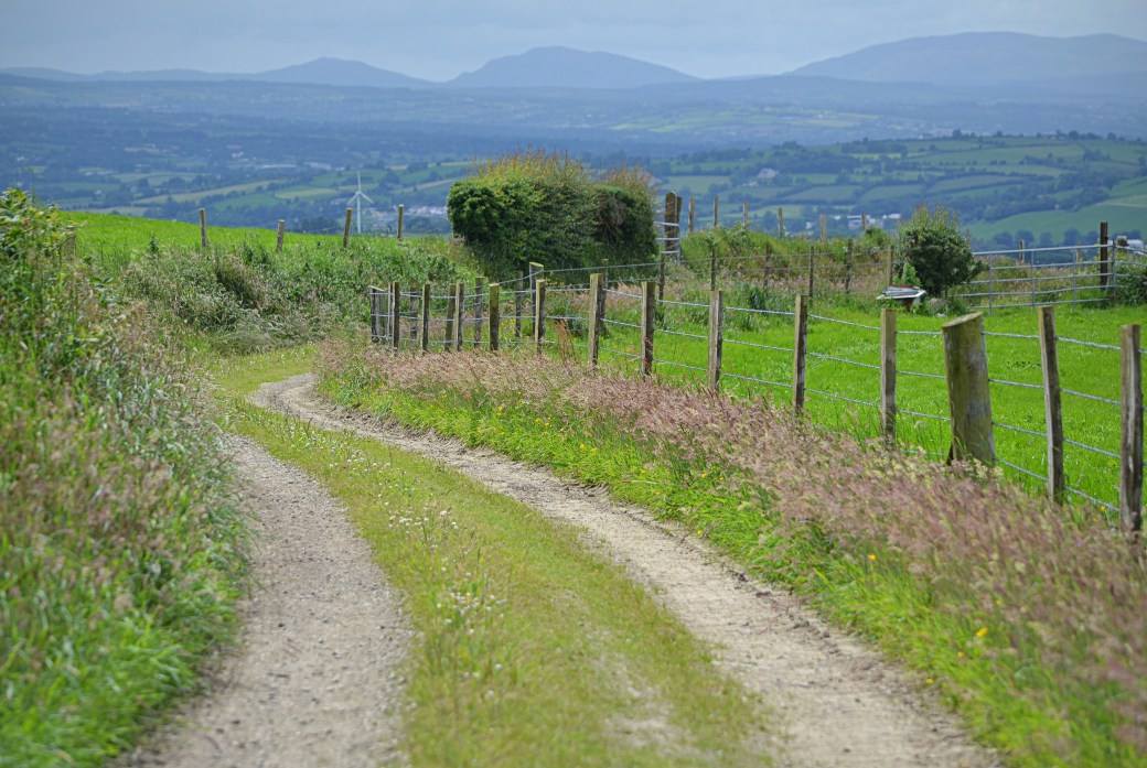
If I ever revisit Knockavoe, I’d probably try to start from the south, via the Evish Road. A short track leads from here towards the summit, though it might be worth asking permission at the house next to it. I descended part of the way via this track but kept to the right, following a longer track which would bring me out on the narrow north-south road to the west of the hill, a little closer to my start point.
Knockavoe’s summit is unusual in that its trig pillar is topped by a metal cross. A similar example can be found on the north cairn of Mullaghcarbatagh in the higher Sperrins.
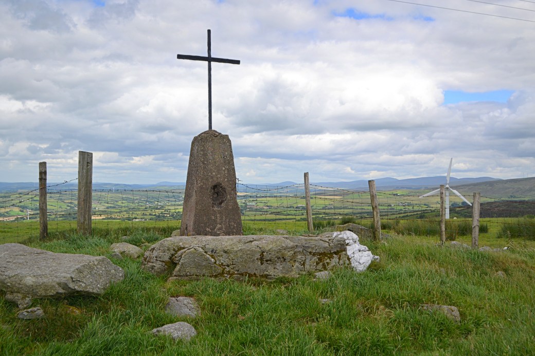
Knockavoe’s summit trig pillar and cross, with some of the higher Sperrins beyond
The views are superb (although largely familiar to me from previous visits to these parts) and I had pretty good visibility on the day. Strabane is spread out immediately to the west, with Donegal’s county town of Lifford on the opposite side of the Foyle (and Irish Border). The Bluestack Mountains loom large beyond, while the Derryveagh Mountains are prominent off to the northwest. It was odd seeing Errigal again after driving past it earlier that afternoon.
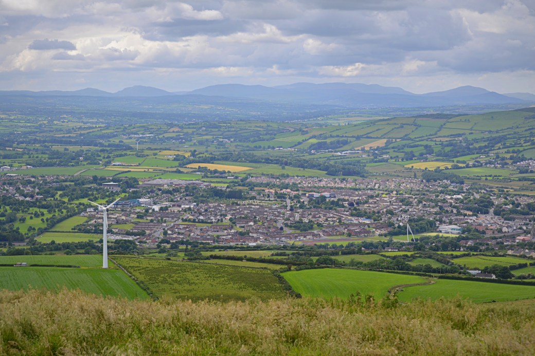
Looking down on Strabane with the Bluestacks beyond

Close-up view of the retail park off Strabane’s bypass, with the Foyle Bridge and part of Lifford beyond
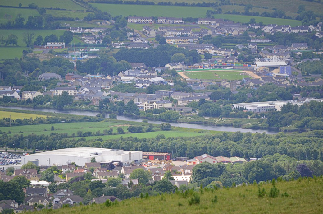
Another close-up view across the Foyle to Lifford; its greyhound racing track is an obvious landmark
You can just make out flat-topped Muckish Mountain on the horizon here
Closer to hand is the main Sperrins chain, though they don’t look particularly impressive from this angle; they’re better appreciated from the north or south. Even nearer, on Koram Hill, is Strabane Transmitting Station, which is Ireland’s tallest structure – a nice distinction for County Tyrone. I stopped there on my way home and an information panel tells the history of the mast and compares its height to similarly well known structures, such as the Great Pyramid of Giza and Empire State Building.
Strabane Transmitting Station, the pride of Tyrone, visible on the left
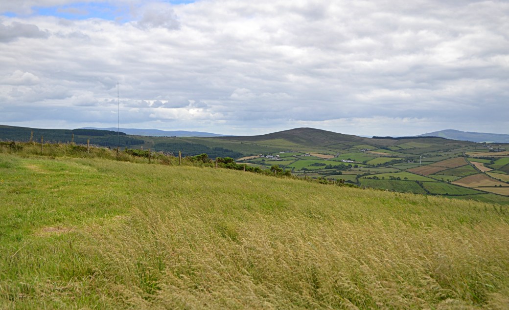
Bessy Bell, near Newtownstewart, is an obvious standalone hill to the south and I could pick out various other outlying hills, such as Slievekirk to the northeast. The views continued to impress as I headed down the track.

Bessy Bell rising above countryside to the south

A last look back towards the summit on my way down, with a few locals resting in the foreground
Looking towards the Bluestacks: the twin mountains in the centre are Croaghonagh and Croaghconnellagh, lying either side of Barnesmore Gap on the main north-south road in Donegal
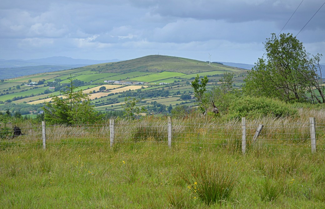
Looking back on Knockavoe from Strabane Transmitting Station
It wasn’t always, but Knockavoe is listed as a summit on the MountainViews.ie website (in their Local/Historical/Cultural category), thanks to the efforts of fellow Tyrone blogger and hillwalker Aidy McGlynn. You can see Aidy’s post on Knockavoe below; it has some nice views of it taken from across the Foyle (which I’d meant to do).
Map: OSNI 12
More information:
www.mountainviews.ie/summit/1498 |
www.aidymcglynn.com/2015/10/03/knockavoe
One last thing worth mentioning is that I completed the Sligo Camino challenge walk this past weekend. This 34km/21 mile route follows the first half of the Sligo Way, between the villages of Dromahair (actually in County Leitrim) and Coolaney.
It was a tough day’s walking, especially the last five miles or so for me, but there are some excellent off-road sections, especially along the shore of Lough Gill and in the hills south of it. It’s a really well organised event, with two food/drink stations and a hot meal at the end, and I’d definitely recommend it for next year.

Some nice pics there on what seemed to be a cracking day for a hike. There’s definitely a rural charm in the general Sperrins area that many people probably can’t appreciate.
LikeLiked by 1 person
Thanks Canice, I always enjoy seeing new views of the Sperrins. They’re at saturation point with turbines though. Think I spotted Mary Gray from the road on the way to Donegal, wouldn’t mind visiting it some time.
LikeLike
Brilliant shots of the views Martin, and thanks for the link! Great wee hill isn’t it – a lot of reward for a small hill and easy walk.
LikeLiked by 1 person
Cheers Aidy, yes it’s definitely a special wee hill. Would love to see the view at sunset on a really clear evening. I was wondering if you went up that track by the house, or went across the fields?
LikeLike
I went up from beside the house Martin, very short, easy walk from there, although as I recall it was across open fields rather than a track. Memory might be a bit unreliable though 🙂
LikeLiked by 1 person
Was wondering as you said across the fields rather than up the track. I’m just trying to work out what’s the ‘permitted’ route as I really don’t think it’s the way I went! The track from the Evish Road seems to be the most direct route though.
LikeLike