I revisited northwest County Donegal for a few days last week and fitted in a hike I’d missed out on during my previous trip to the area, back in June.
Cnoc Fola (also known as Bloody Foreland, even though the Irish name translates as ‘hill of blood’) is a spud-shaped hill which dominates the landscape of this extremity of Donegal/Ireland, between Derrybeg and Magheroarty.
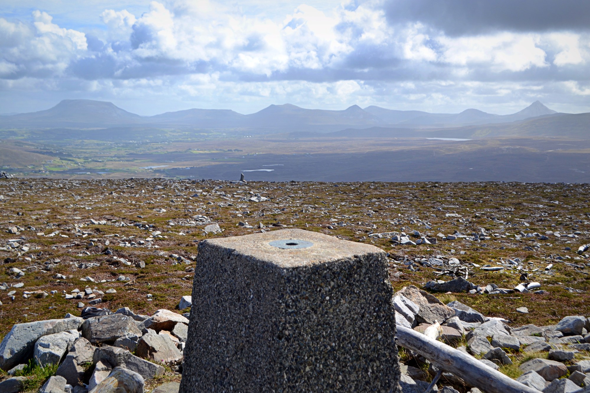
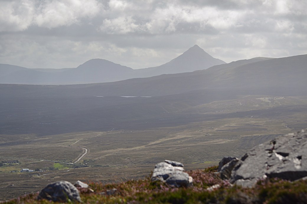
Top image: the Derryveagh Mountains from Cnoc Fola’s summit
Despite being a relatively low 314m, it was a prominent sight from my walk along Falcarragh Beach last time and I’d tried to imagine its 360 views of headlands, mountains and islands.
After reading up on it on the Mountainviews.ie website, I decided to tackle Cnoc Fola from its northern side, as this would avoid any potential access issues. I found an appropriate spot to park on the R257, to the east of a steep, rocky stretch, and just past a quarry entrance.
The going wasn’t too bad as I contoured up the hillside, avoiding the steeper ground to my right and enjoying the easy terrain. Initially hazy views soon cleared and expanded to take in landmarks such as Tory Island to the north and the length of the Derryveagh mountain range off to the southeast, Muckish and Errigal being the most recognisable summits and lying at either end.
Cnoc Fola offered one of the best vantage points I’ve seen of the line of shapely mountains that make up the Glover Highlander challenge walk. It also occured to me afterwards that I’d often seen this view in reverse from my more local Sperrin Mountains.
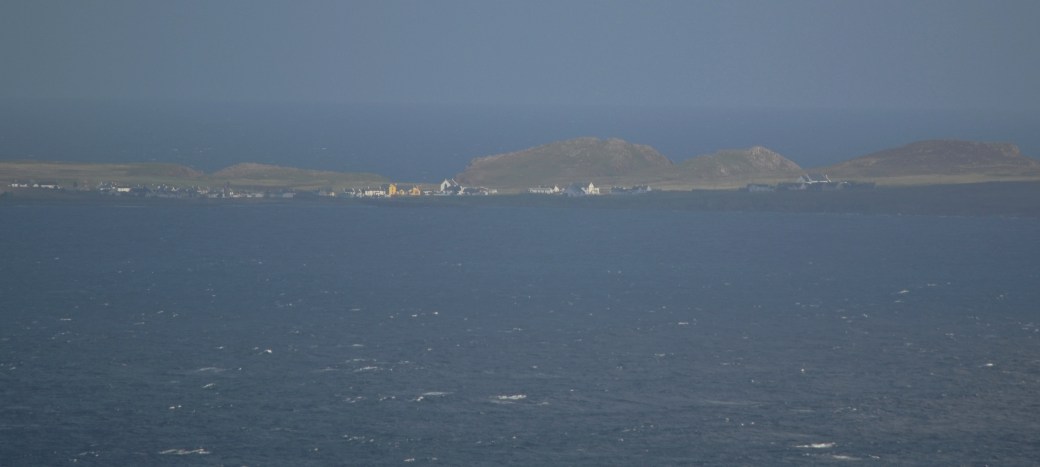
The full length of Tory Island plus a zoomed in view of its harbour area, seen during my ascent
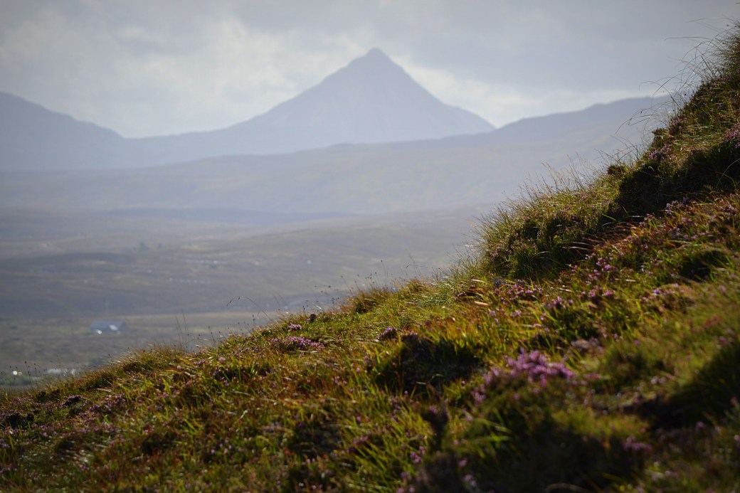
Errigal looking particularly pointy from this aspect; the lower image also includes its near neighbour, Mackoght
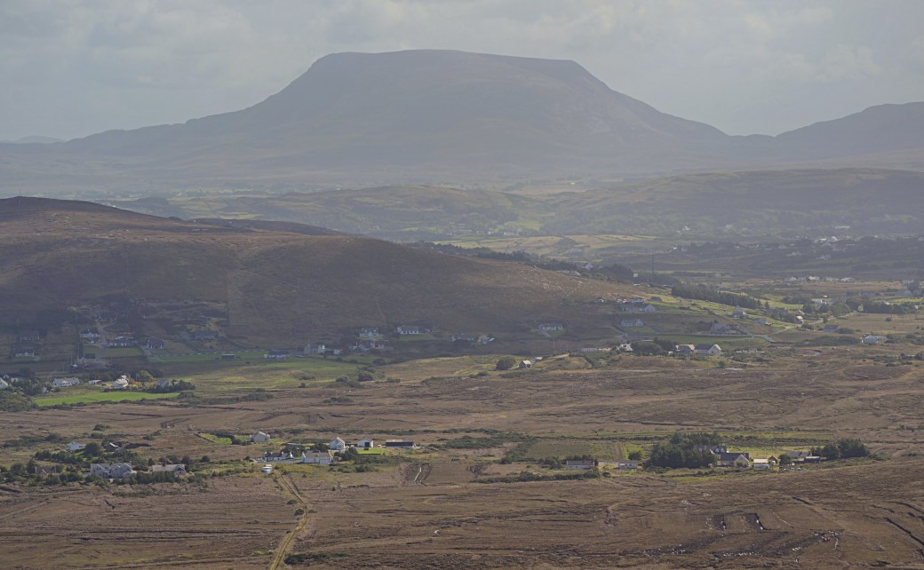
A close-up of mighty Muckish
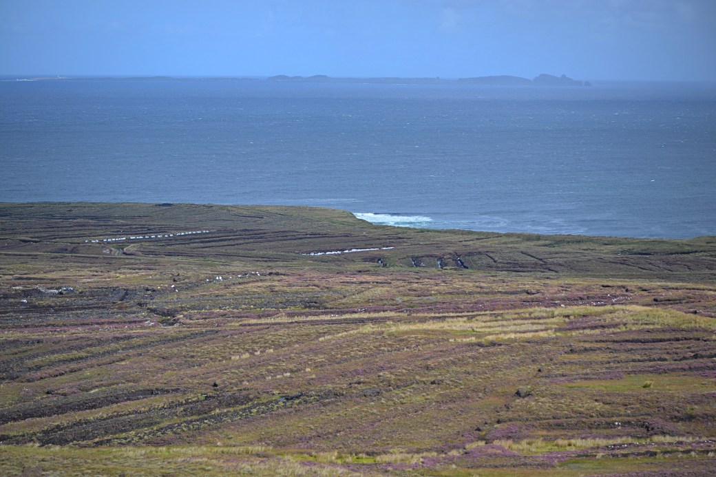
I spent some time at the summit cairn and trig pillar, where I was surprised to meet a group of eight fellow hikers who’d come up the hill’s eastern side. The views back in the direction I’d travelled from, around Gweedore and beyond to the Rosses, remained hazy but you got a feel for the intricate coastline and numerous islands.
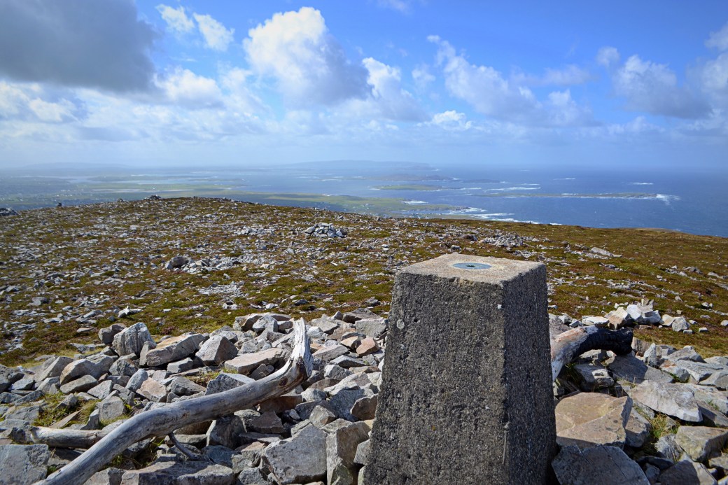
The view southwest down the coast from the summit
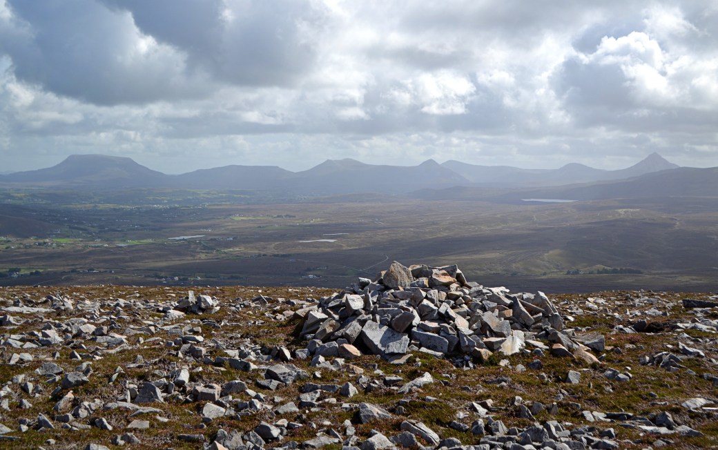
Another view to the Derryveagh Mountains, taken near the summit
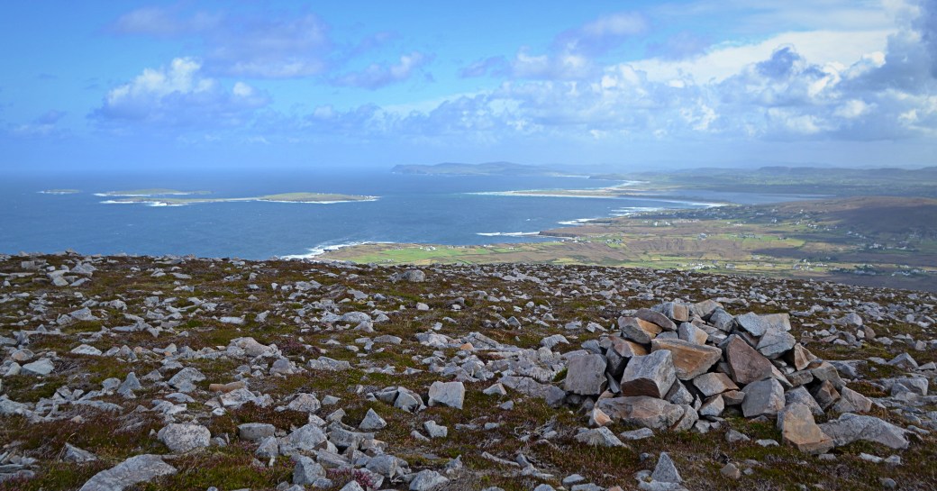
View across the coastline to the northeast, with Horn Head visible in the far distance
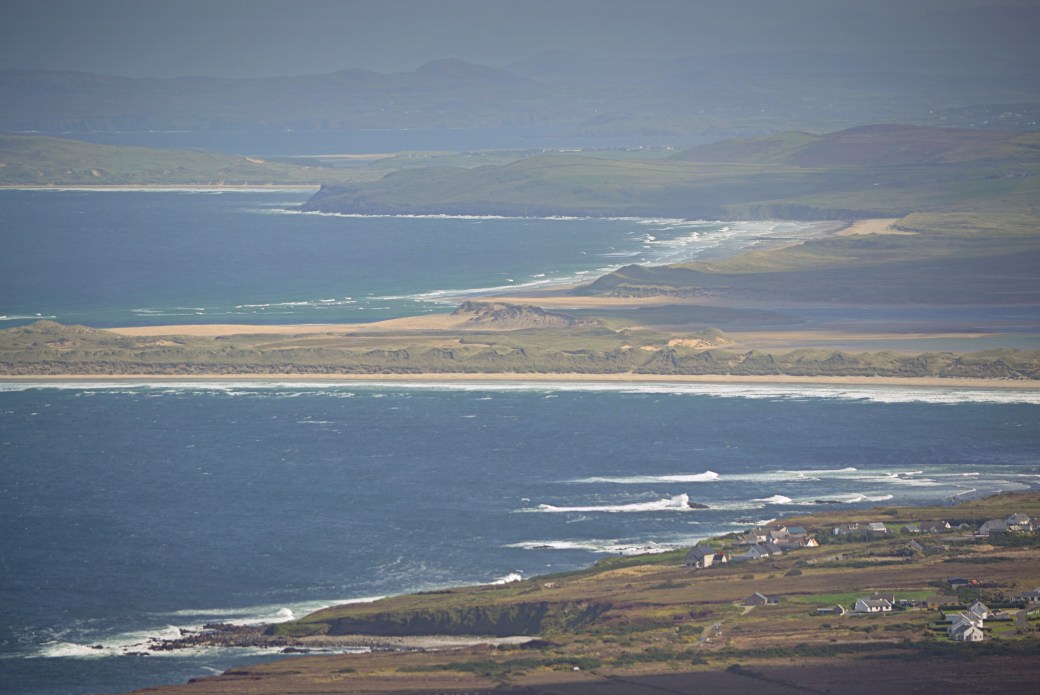
A closer look at the sandy beaches of Magheroarty and Falcarragh
My descent was via much the same route. I recorded the hike using Strava and got an aerial video route using the Relive app, which you can see here.
Total distance: 3.3 km / 2.1 miles
Map: OSI 1
More info:
Cnoc Fola listing on MountainViews.ie website
Earlier posts you might enjoy:
Donegal: Around Falcarragh |
Unfinished Business Part 2: Slieve League |
Donegal: Aghla Mountain

Great post. The pictures are brilliant, what great views.
LikeLiked by 1 person
Thanks Ashley, it was stunning up there.
LikeLiked by 1 person
Nice route. Love the lengthy panorama of the mountain range. Also the relive app gives a great sense of aspect. Nice to trace the walk.
LikeLiked by 1 person
Thanks Canice. Planning to use Relive for all hikes now, this one came out well despite the short distance.
LikeLike